After having spent two posts in the south of Iceland, now we shall journey to the north of the island, to the Skjálfandi Bay and Húsavík, a town on its eastern shore.
Continue readingIceland Log: Skógar Museum and Skógafoss
One of the first stops along our trip around Iceland was Skógar. At any given day (especially in the summer), Skógar probably has two to four times more tourists than residents — that’s how tiny the town is. In spite of its tiny population, however, Skógar is definitely worth a stop for two reasons: its museum and its waterfall.
Continue readingIceland Log: Vík í Mýrdal
In summer of 2022, my wife and I took a trip to Iceland. We drove all around the country (literally; the country is encircled by a ring road and we drove the entire thing) and got a chance to see (and learn) quite a few things!
Our first trip took us to Vík í Mýrdal, commonly just called Vík. Vík in Icelandic just means “port”, which is kinda funny because Vík does not actually have a dock. That said, Vík was still a port town: earlier in Iceland’s history, an important resource was driftwood and flotsam which washed up on shore. Due to its location, Vík was a place where much of these things washed up. Ships would also moor outside the harbor and send small boats to shore to drop off people or supplies.
Continue readingRead my words
Hello blogfriends!
At the time I am writing this, most of the nation, and indeed much of the world, have been instructed to remain at home in order to prevent the spread of a particularly infectious virus. While this turn of events is not widely regarded as positive, it does provide extra time for working on projects which have been neglected for a while, such as this site.
So instead of doing that, I have created another site which I can also neglect.
The new site is specifically for my writings, both non-fiction and (occasionally) fiction.
The new site is here, should the idea of reading some of my stories and other writings interest you.
I will be populating it with stories I have already written, and once that process is complete I will hopefully continue populating it with stories which I have not yet written.
I hope you enjoy! I also hope that I will continue to update this blog. Perhaps with two of them, together they will form one reasonably well-updated blog.
Perhaps.
New Zealand Farewell Tour, Pt. 4: Cable Bay, Kerikeri, and Rainbow Falls
Well friends, this is it. The farewell to…my farewell tour? This is getting a little meta.
As you may recall from last time (and if you don’t, may I recommend a quick refresher?), I reached my destination of Cape Reinga. After a brief trip to Tapotupotu to clear my head from all the tourists, I began my trip back to Auckland.
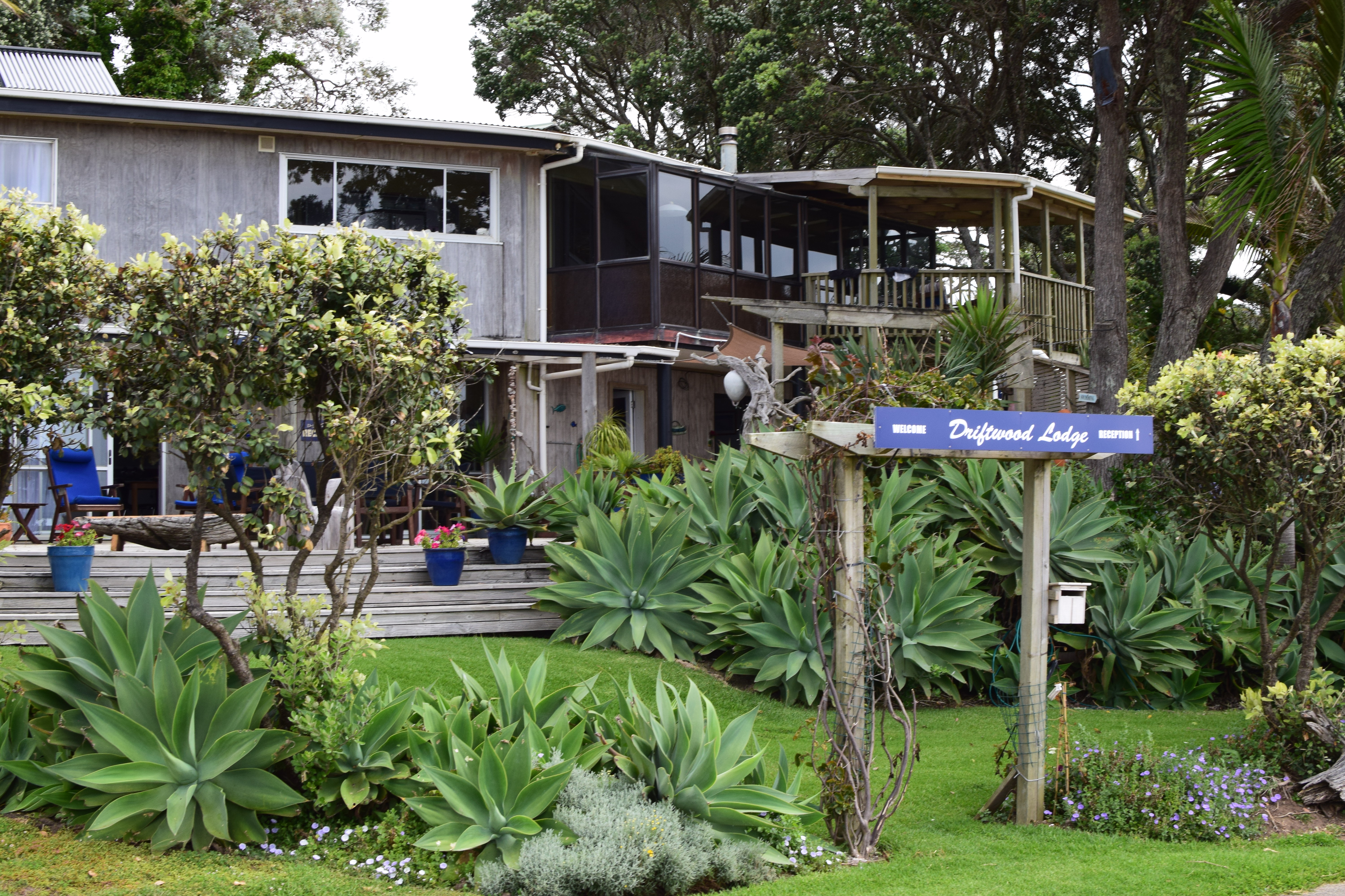
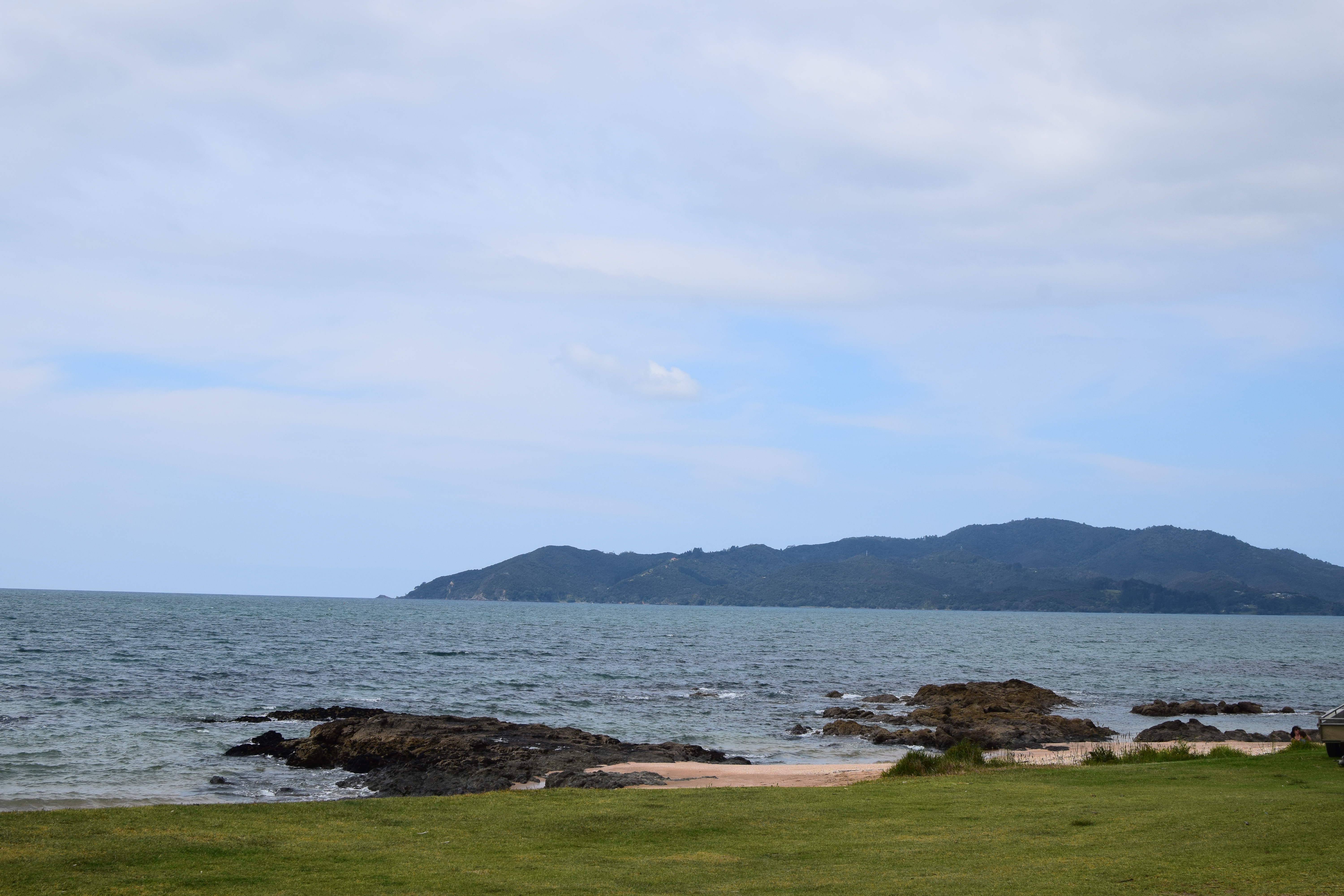
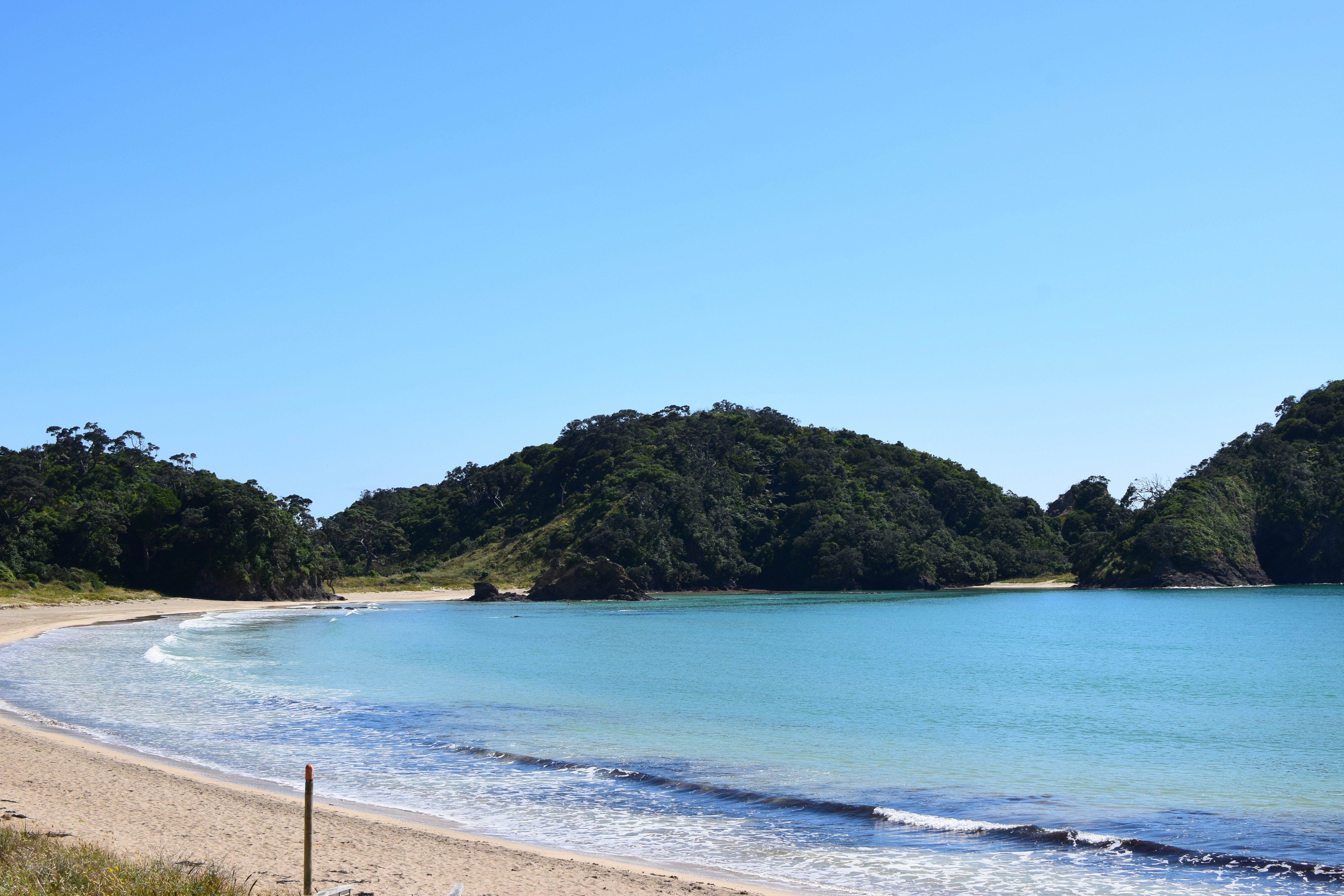
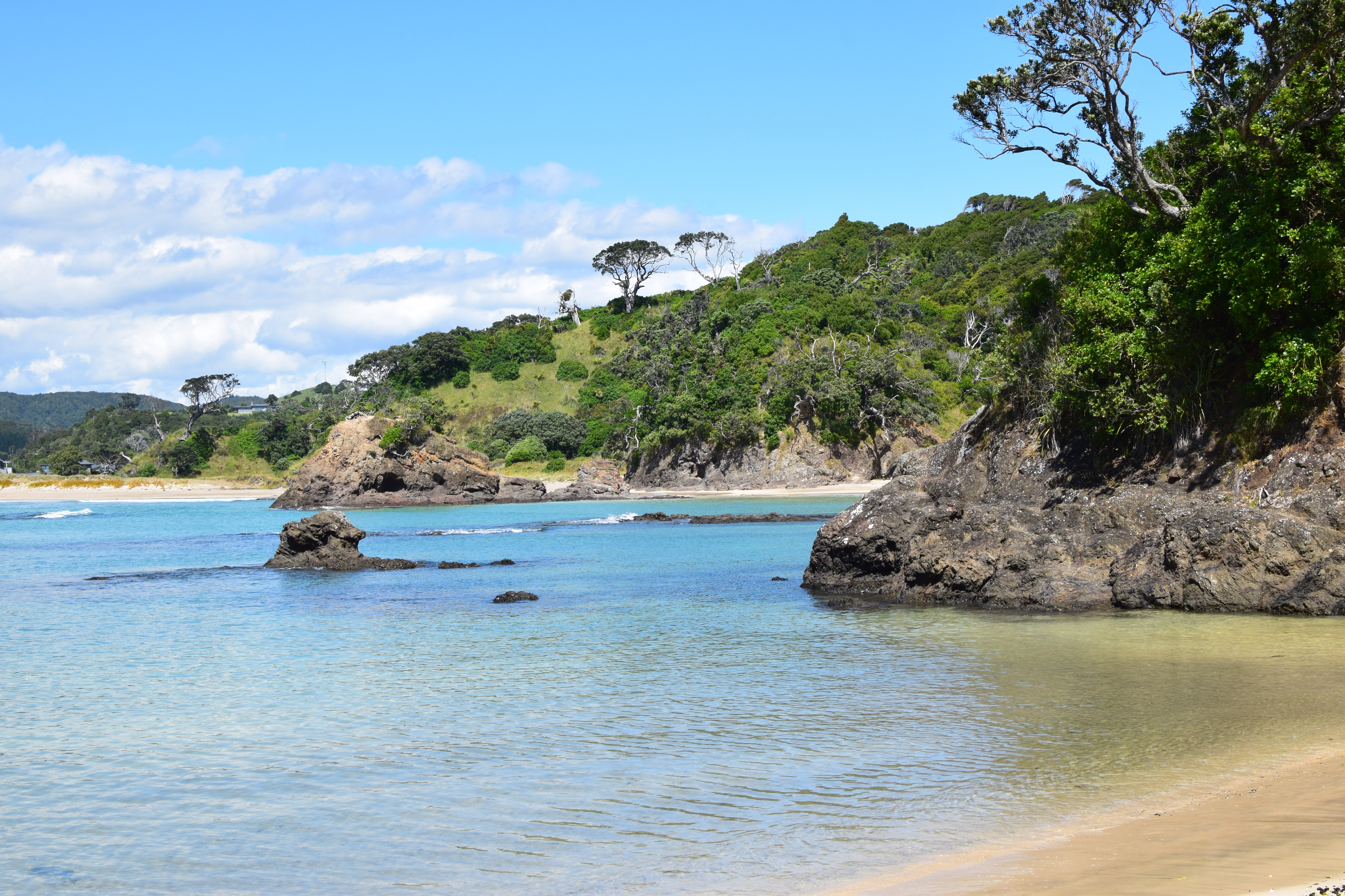
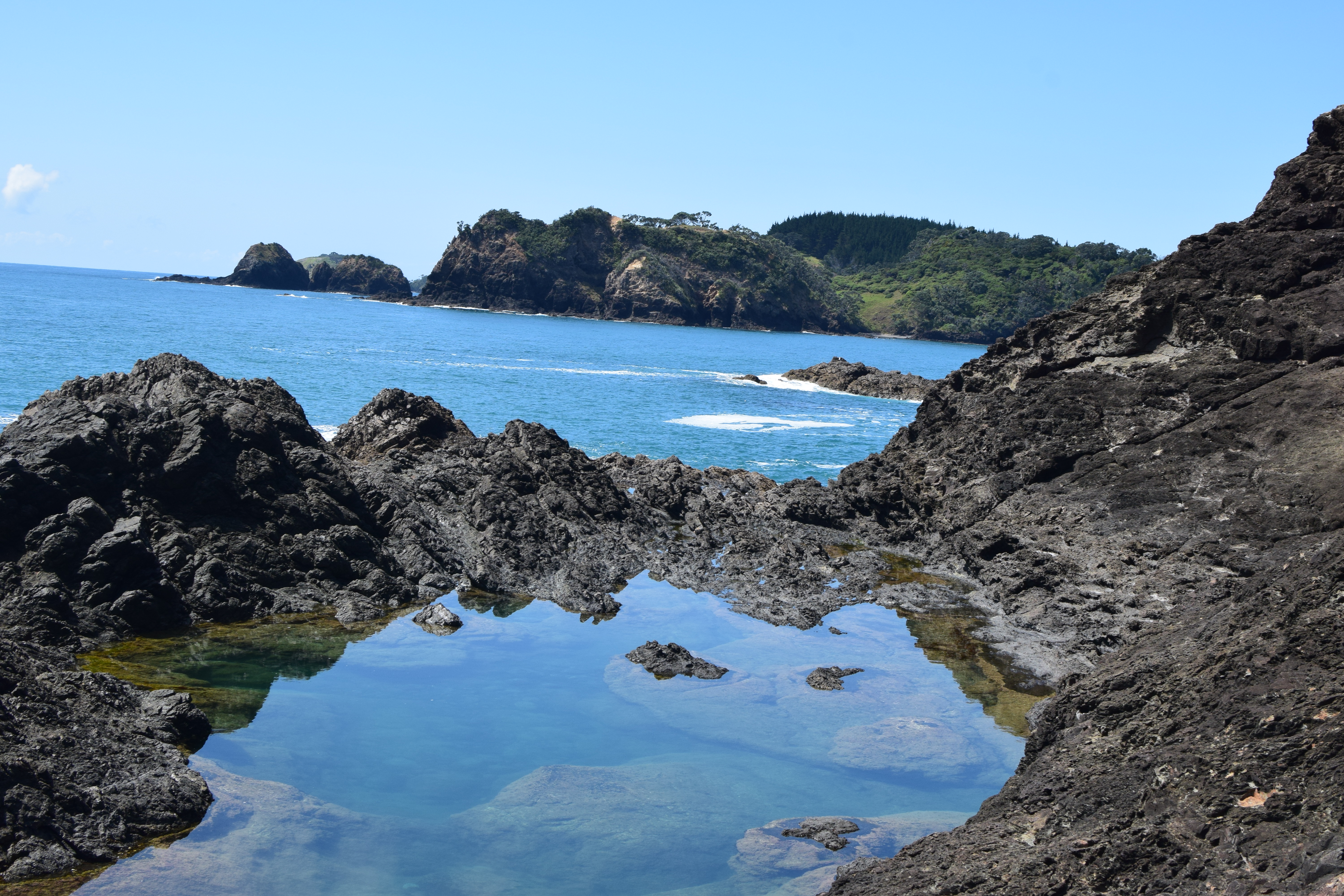
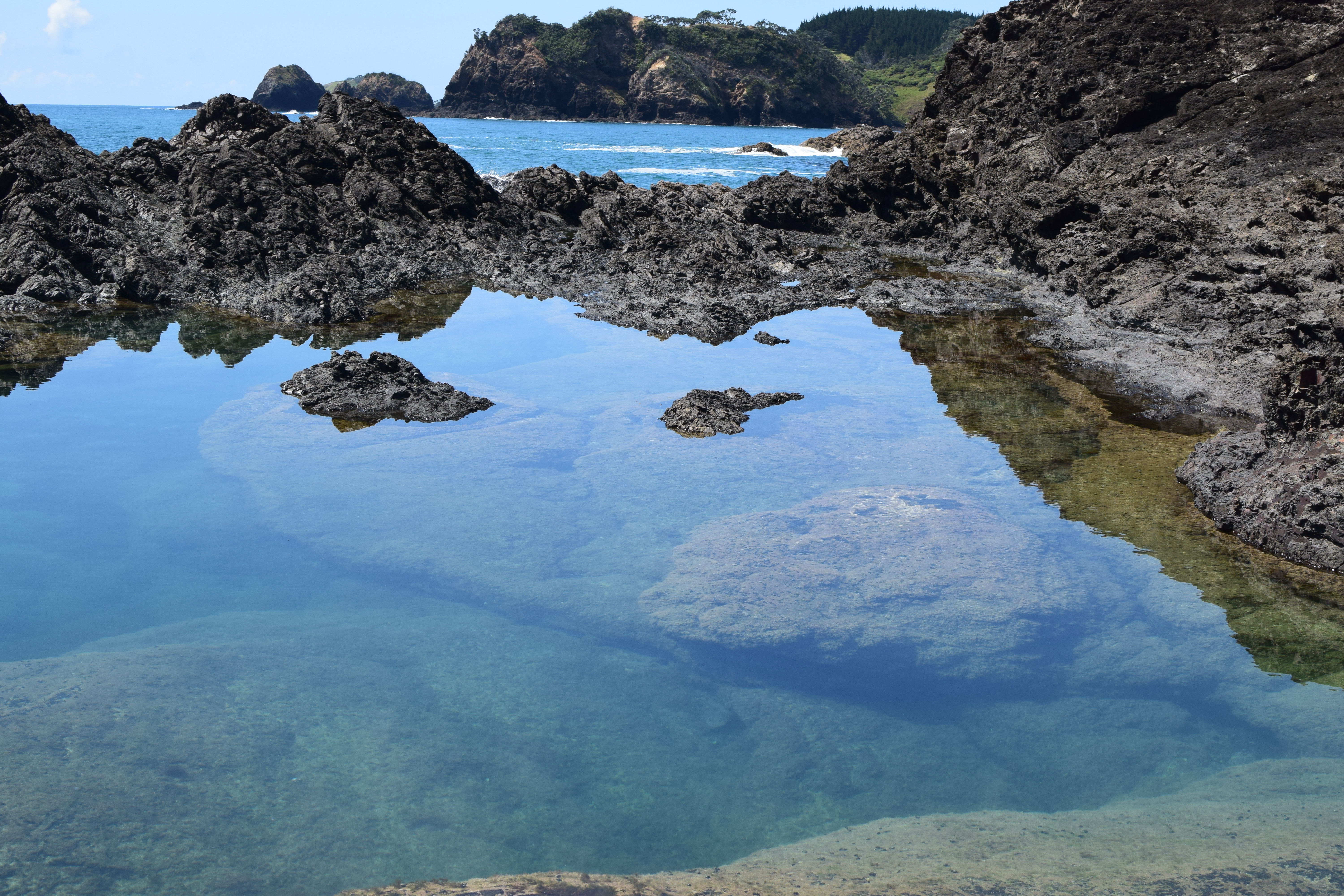
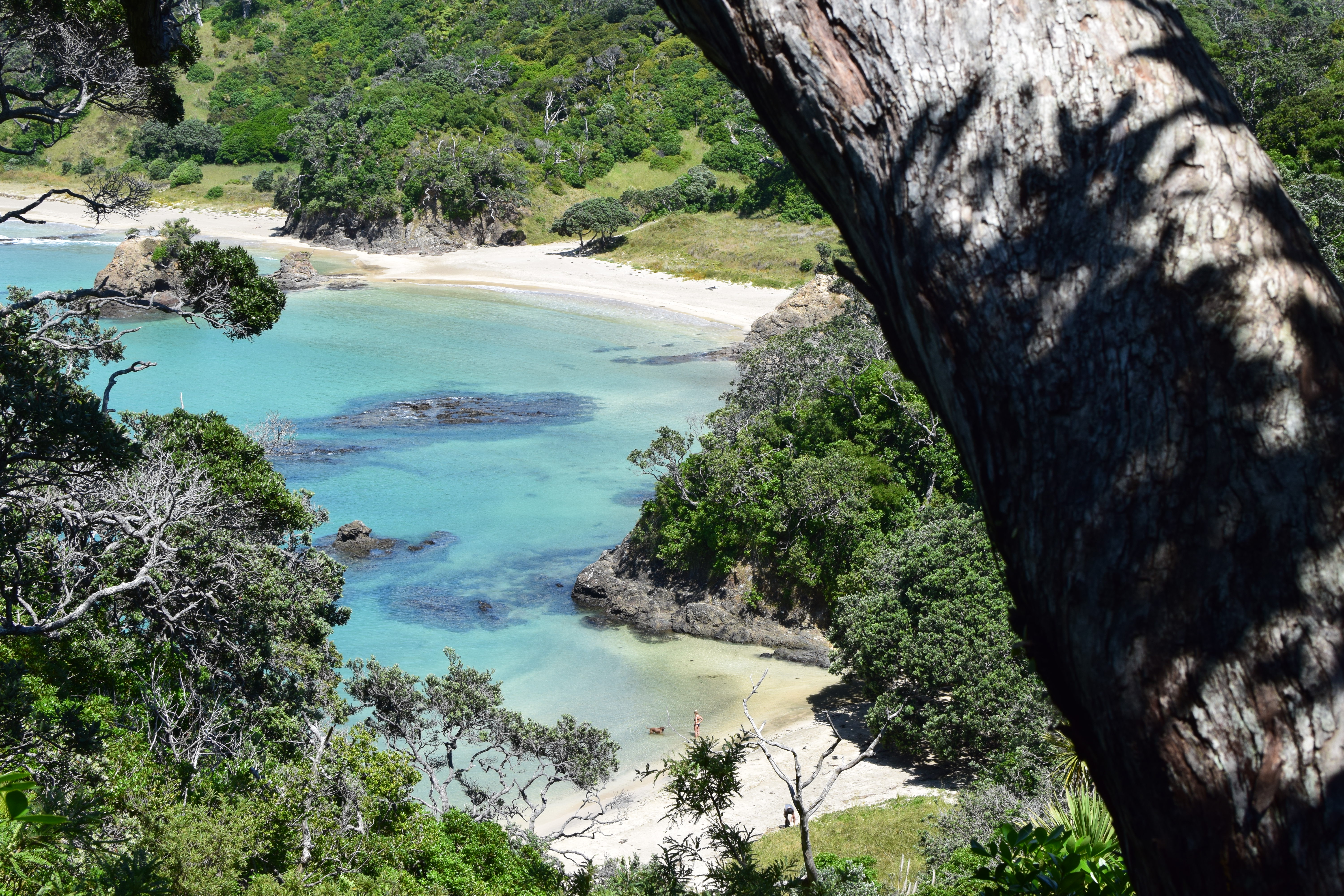
Before heading back, though, I had one more night to spend in the Northlands. That night was to be spent at Cable Bay, a small part of Doubtless Bay, a large inlet not too far from Mangonui. I was to stay at a charming inn called Driftwood Lodge.

The lodge is very much on the bay! This is the view from the front door of my room. I love my family very much, but if the couple who run the lodge had offered to adopt me and let me live there, I would have had a hard time saying no!

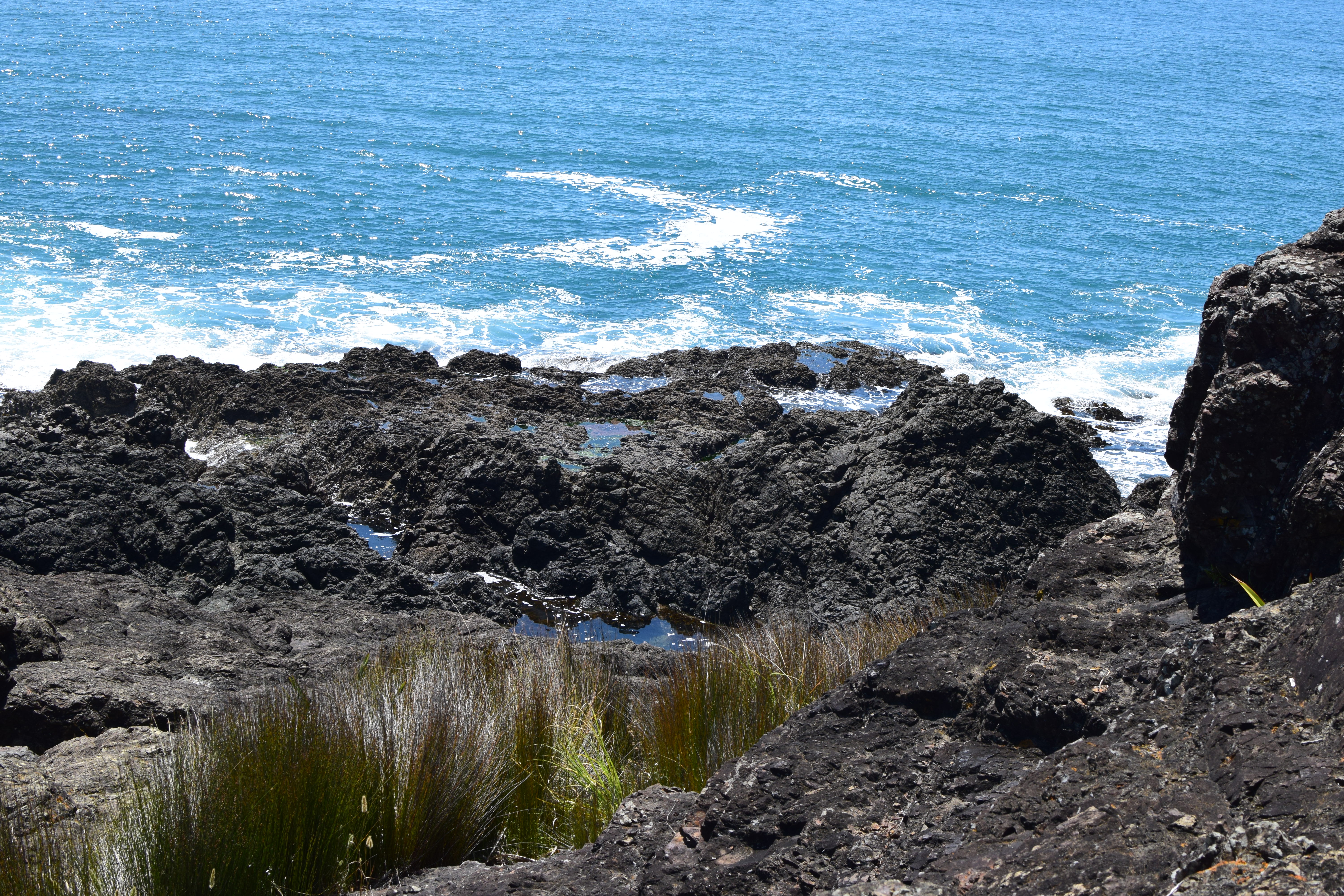
Cable Bay shares in the stunning beauty that seems to be par for the course in the Northlands. I personally believe this area can give the Bay of Islands a run for their money! Not that this statement is casting any shade on the Bay of Islands; that’s just how beautiful this area is!
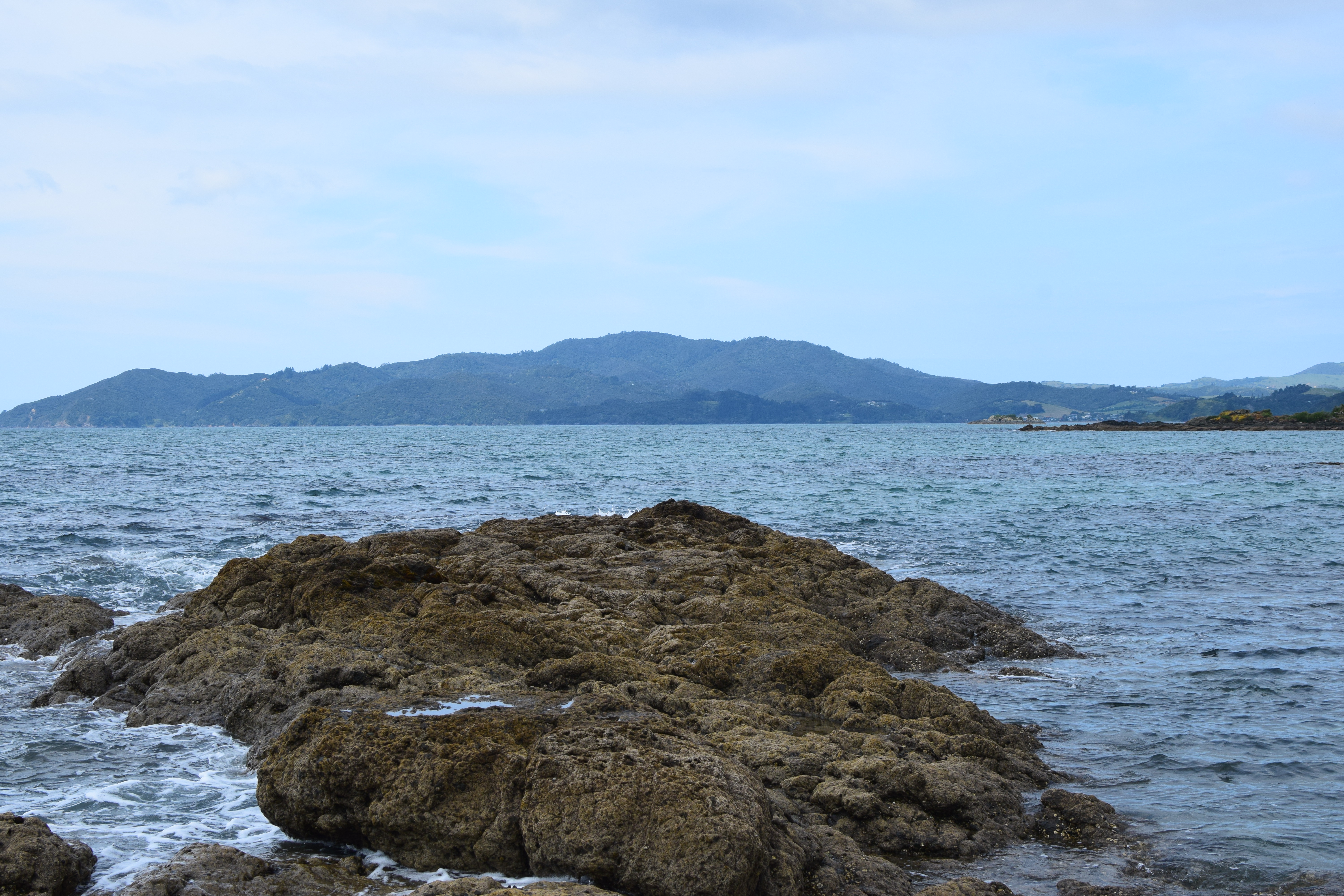
As you can see from the chop in the water, it was a bit windy. But for a late Spring day, it was absolutely fantastic!
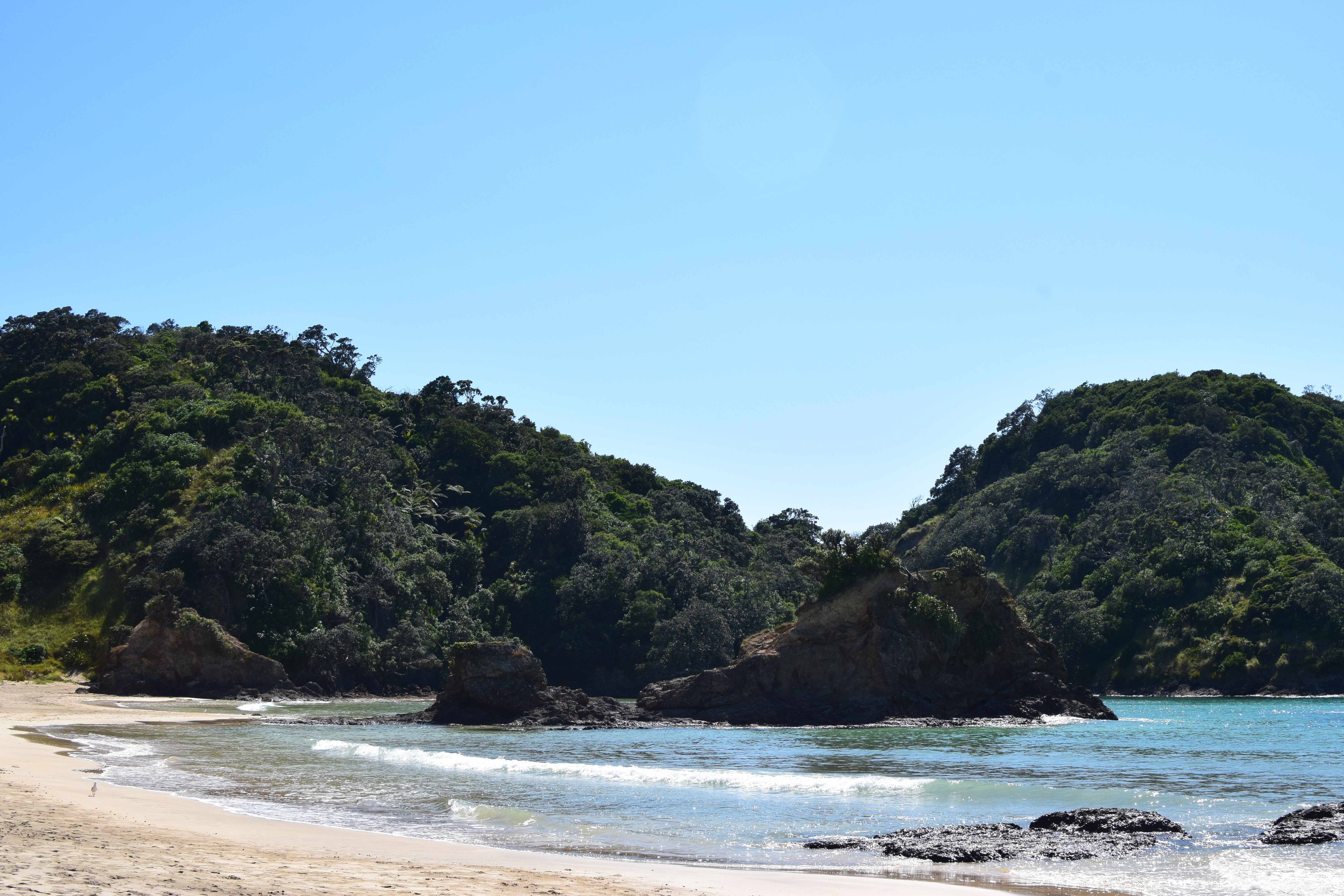
As you can see, the lodge itself is quite secluded. The beach is public and anyone can walk around on it, but at least in November it seems that only a few did. Just as well; I was enjoying having it mostly to myself!

You may be thinking this shot was taken at high focal length with the big lens. Nope! This is the 35mm. I was able to get this close using my own two feet :)

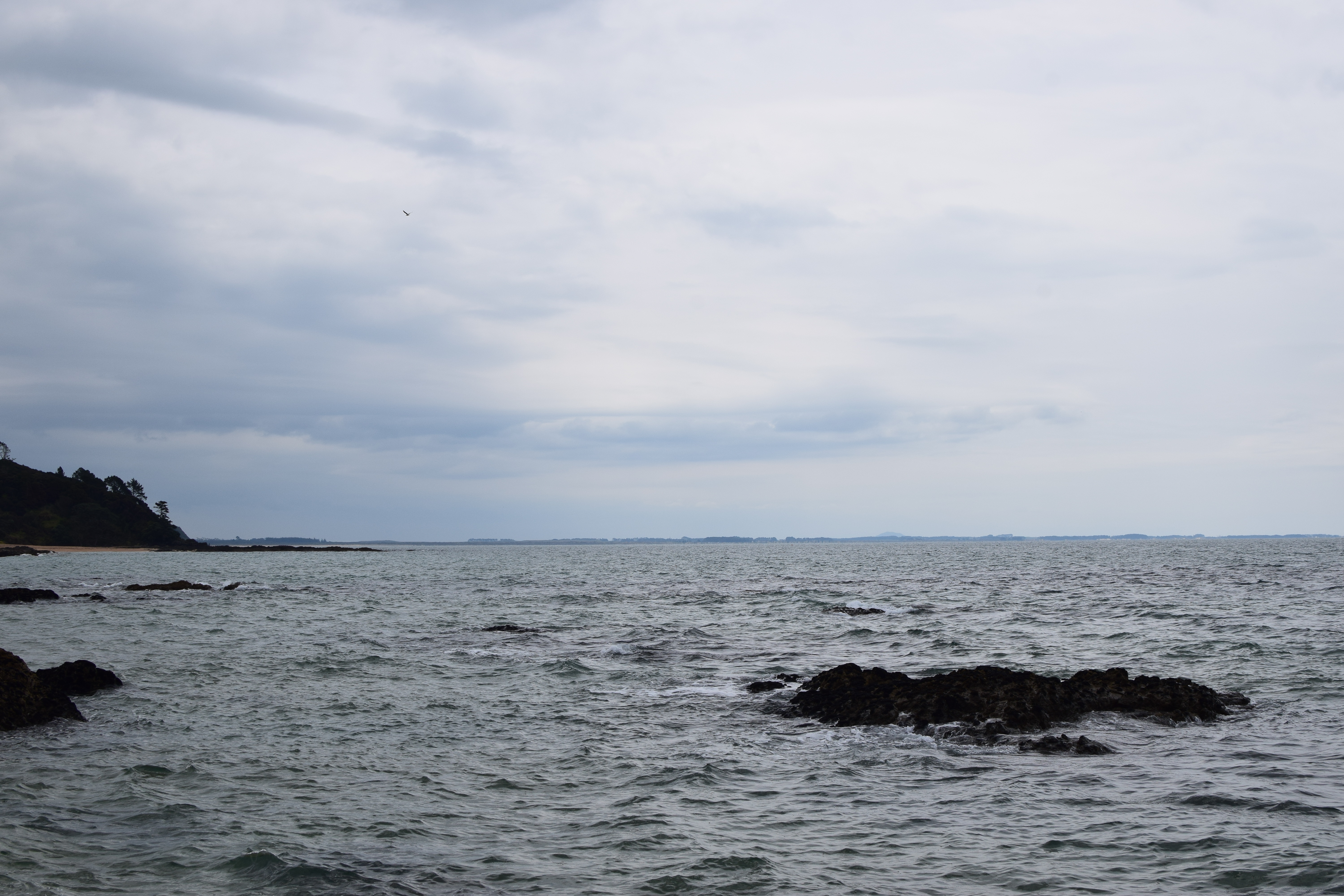
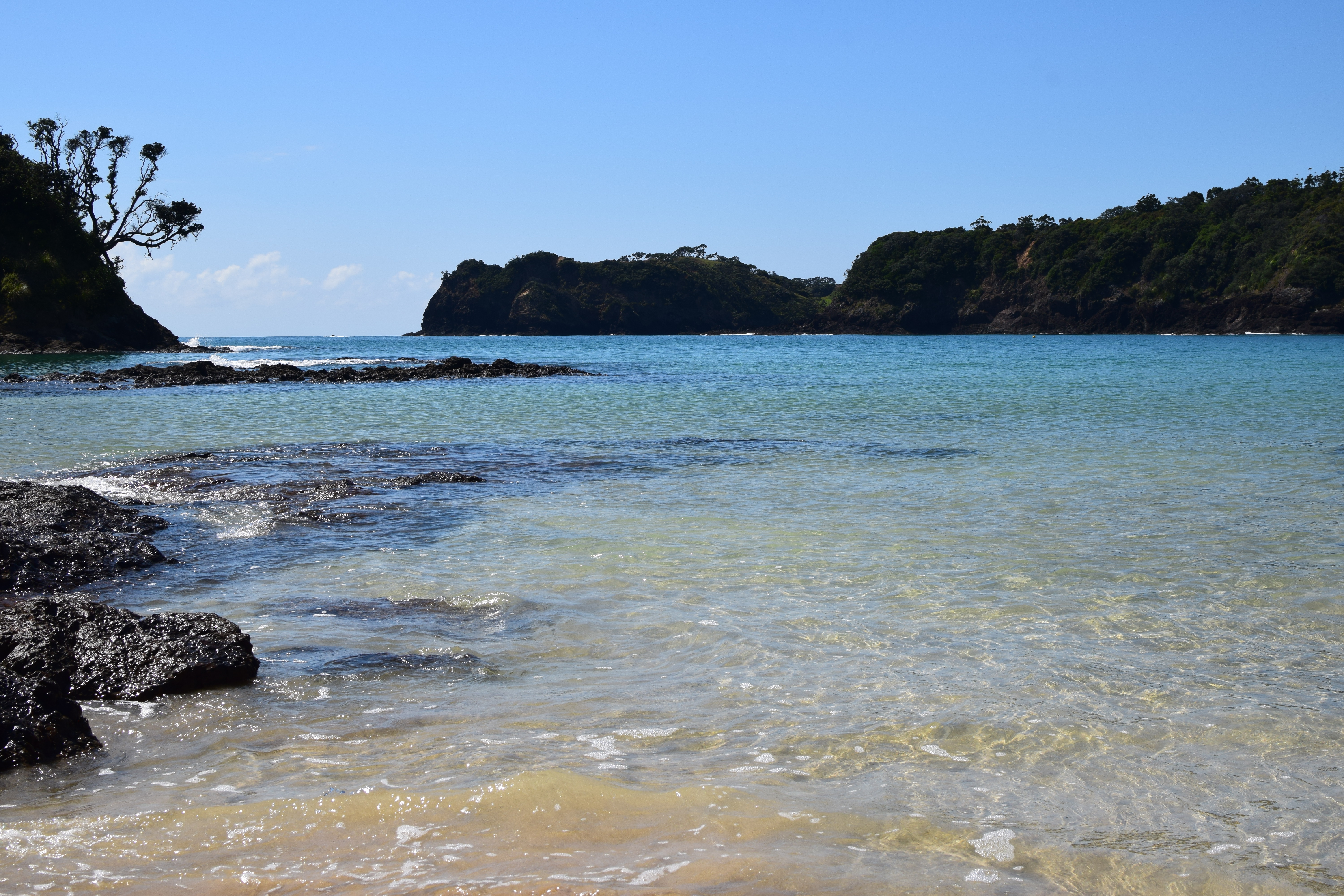
I decided to take a bit of a meander down the beach, and I do not at all regret this usage of the last hour or so of sunlight.

Near the end of the beach there’s a sort of play area and some benches. I enjoyed sitting on these benches just contemplating the ocean.

Cable Bay is calming and restful, full of the effortless beauty that New Zealand has seemingly boundless supplies of.
Mangonui
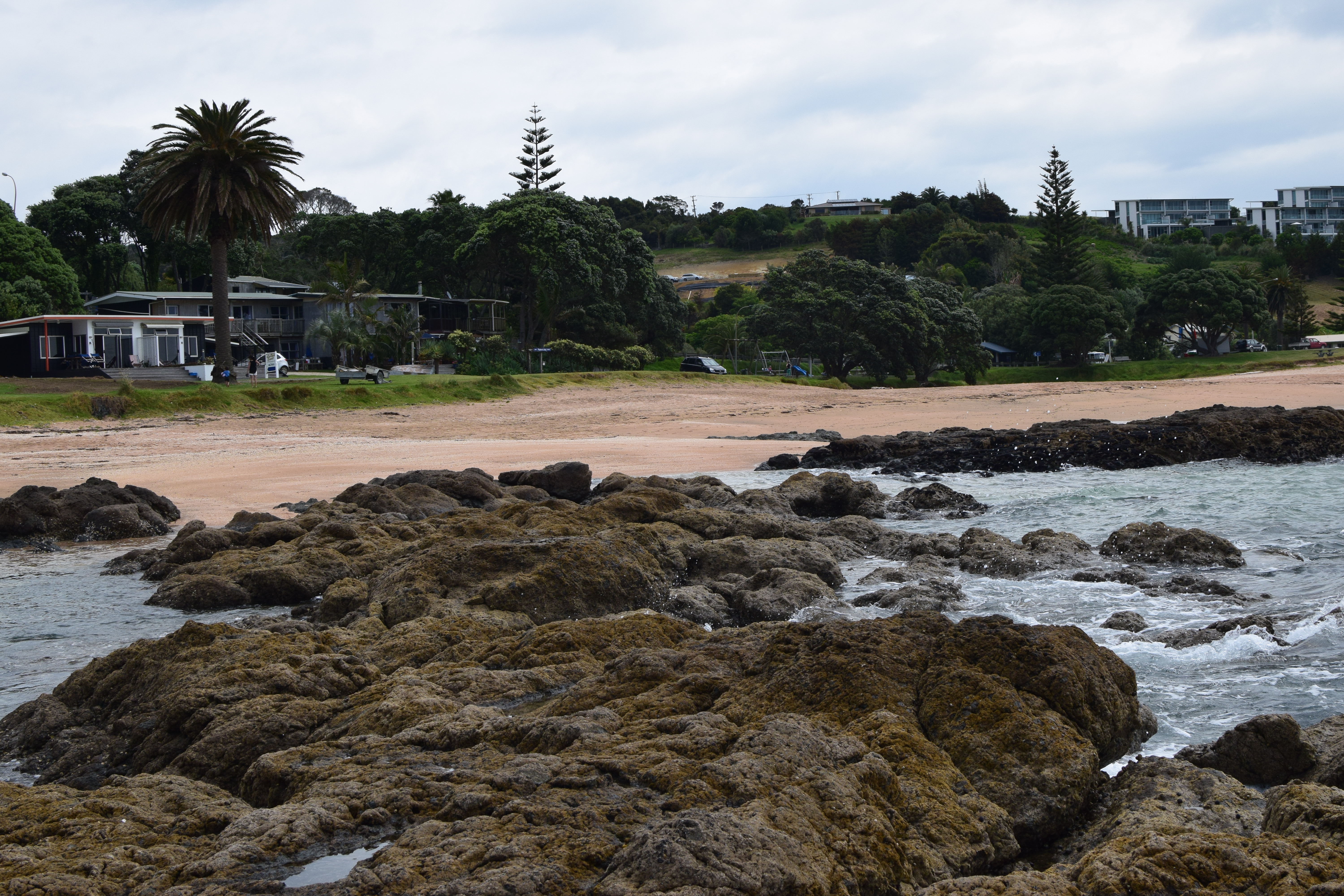
The sun was taking ages to set, so I got in my car and drove the ~7 minutes over to Mangonui, the nearest town.

Most things were closed up, but I spent some time walking around and just enjoying the small town feel. Mangonui is really just a couple of roads, so there’s not much “town” there. It is quite a charming place though!

As the sun finally went down I managed to snap one more shot, this from the dock area in Mangonui.
The Return
Of the rest of the trip, there’s not much more to say. After spending a delightful night in the Driftwood Lodge, I packed my stuff and set off back to Auckland. In less than a month, I would be getting on a plane and flying back to the US.

A portion of my heart will always, always reside in New Zealand. There is no doubt in my mind that I will be back one day.
I use the word “home” liberally. Home is in Knoxville, Tennessee, in the house my family have lived for 25 years. Home is in Raleigh, North Carolina, where I moved 12 years ago and where, as I write this, I currently reside. But home is also in Auckland, New Zealand, where I have dear friends, a church, and so many memories. Ultimately, as I have said before, my home is in heaven. My entire life is a journey along the narrow road leading home, and it should be no surprise as I move from home to home along that road.
Thank you for sharing in this journey with me. It’s been a year and a half now since I moved back, and only now am I really able to write about leaving. I write with sadness but no regret. And I also write hoping that I find the time and energy amidst life’s vicissitudes to occasionally post photos from my continuing adventures!
Thus, I will not say goodbye, but rather: ’til next time!
New Zealand Farewell Tour, Pt. 3: Cape Reinga and Tapotupotu
Thanks for joining me on my Northlands adventure! If you’re new here, I recommend you start at part 1 first so you know what’s going on. Or not! I’m not here to tell you what to do.
After spending the night in Paihia, I embarked on the next leg of my journey: driving North until I run out of road. Although actually said trip North began by driving South! My intention was to join the Highway 1 at Pakaraka, slightly Southwest of Paihia, and then head Northwest along 1 until hitting Cape Reinga. And although I could have cut directly over on the B roads, I had experienced enough twisty turny roads for a while and wanted to stay on the main motorways.
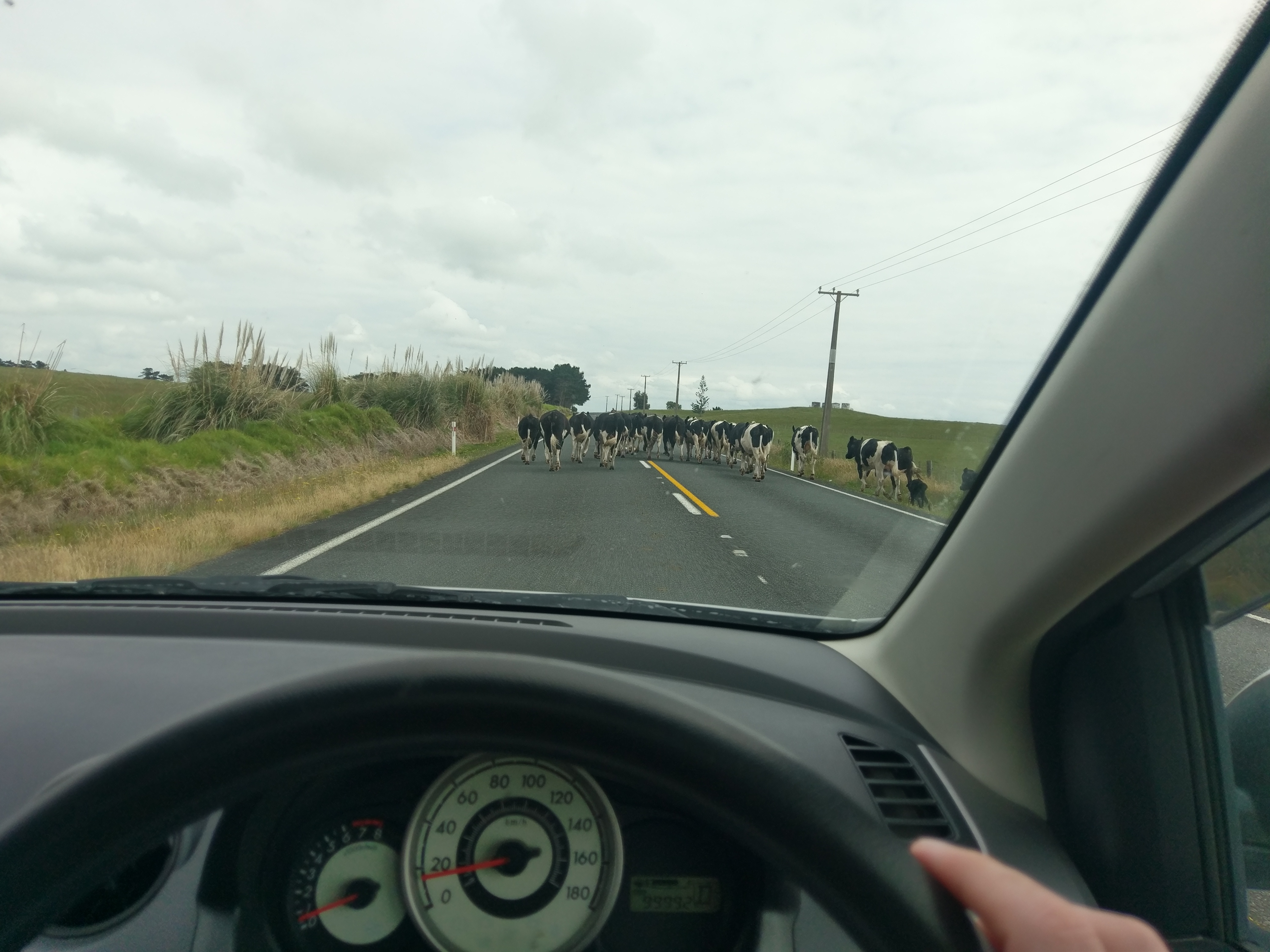
Of course, even on the motorway sometimes you run into traffic.
The drive up to Cape Reinga is actually not too bad. It’s mostly farmland, of course, but there’s the occasional interesting view or quaint little town. One does have to take some care to manage petrol correctly, as filling stations (or signs of civilization in general) can be few and far between!
After about three hours of driving, depending on how many herds of cattle you have to slow down for, you get to the Northernmost point of the North Island!
Cape Reinga
Cape Reinga is, to be honest, full of tourists at nearly all times. Several busloads came and went while I was there. It’s a pretty neat little place, but it’s so overrun. And this wasn’t even at peak tourist season! I can’t imagine what it’s like in January and February.
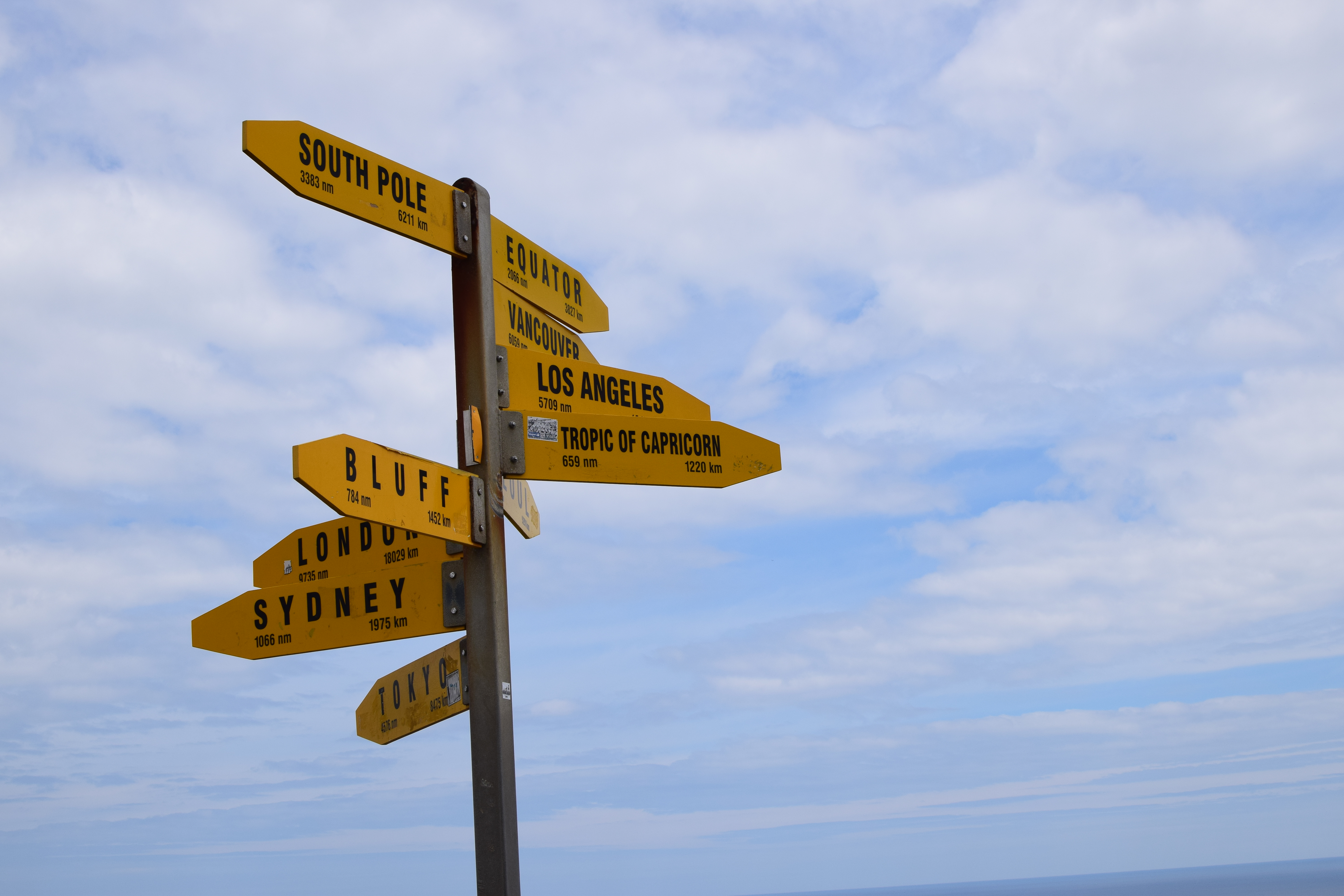
It’s also full of photo ops, such as the above signpost (which is the subject of a much deeper discussion I get into here).

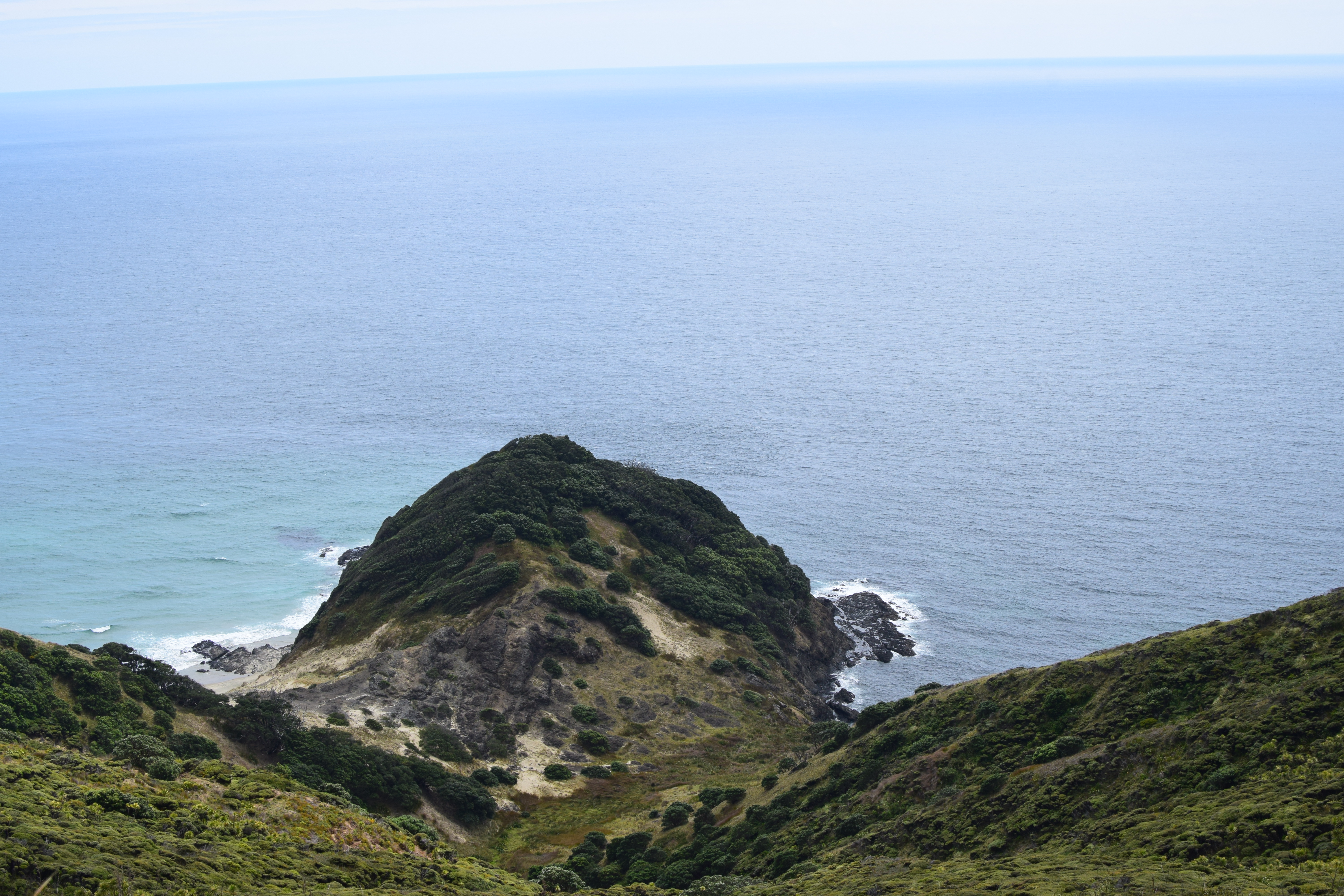
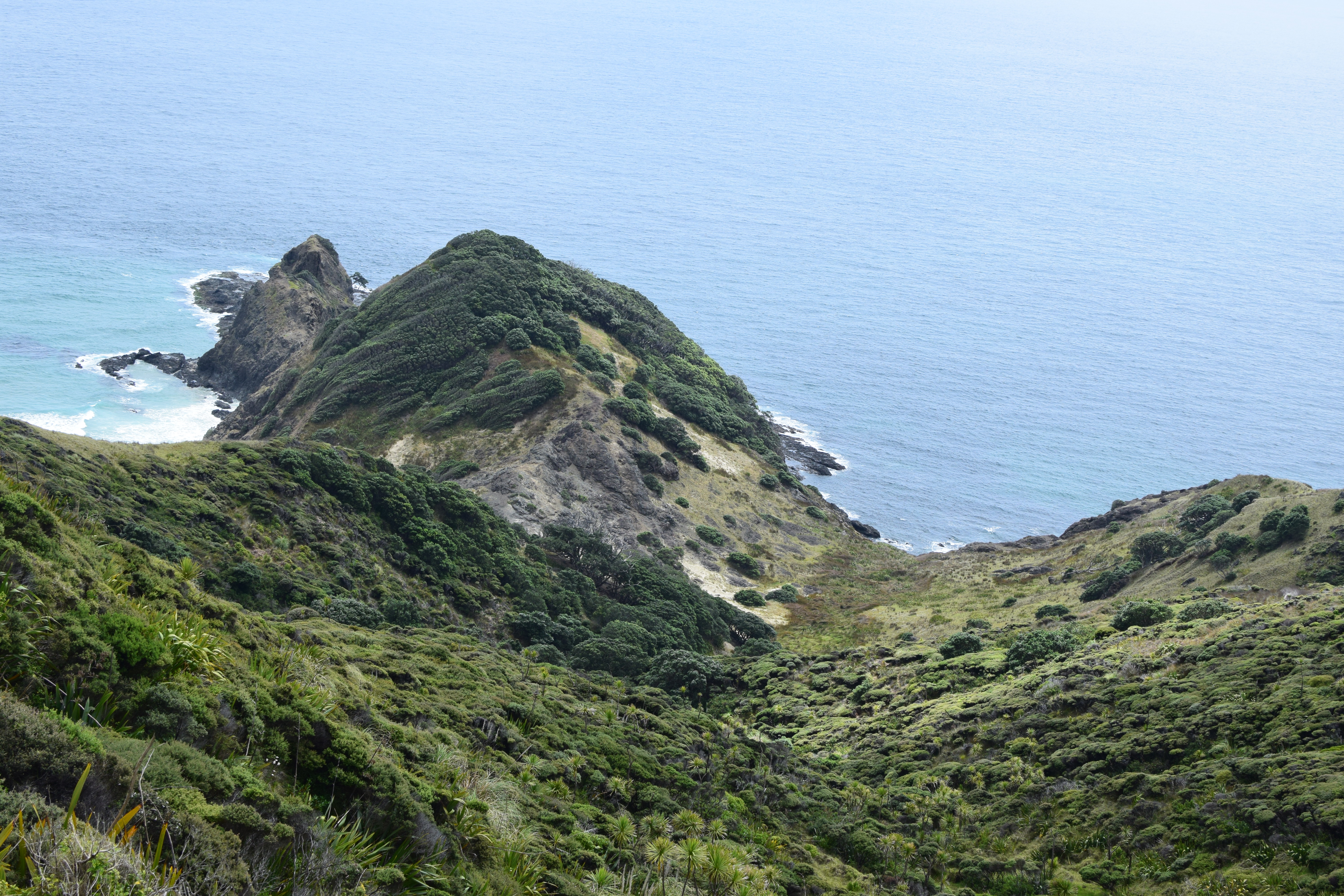
Despite its tourist-filled nature, however, Cape Reinga is mostly walking trails. There’s some well-paved tracks, but a lot of the cooler views are footpaths like this one.
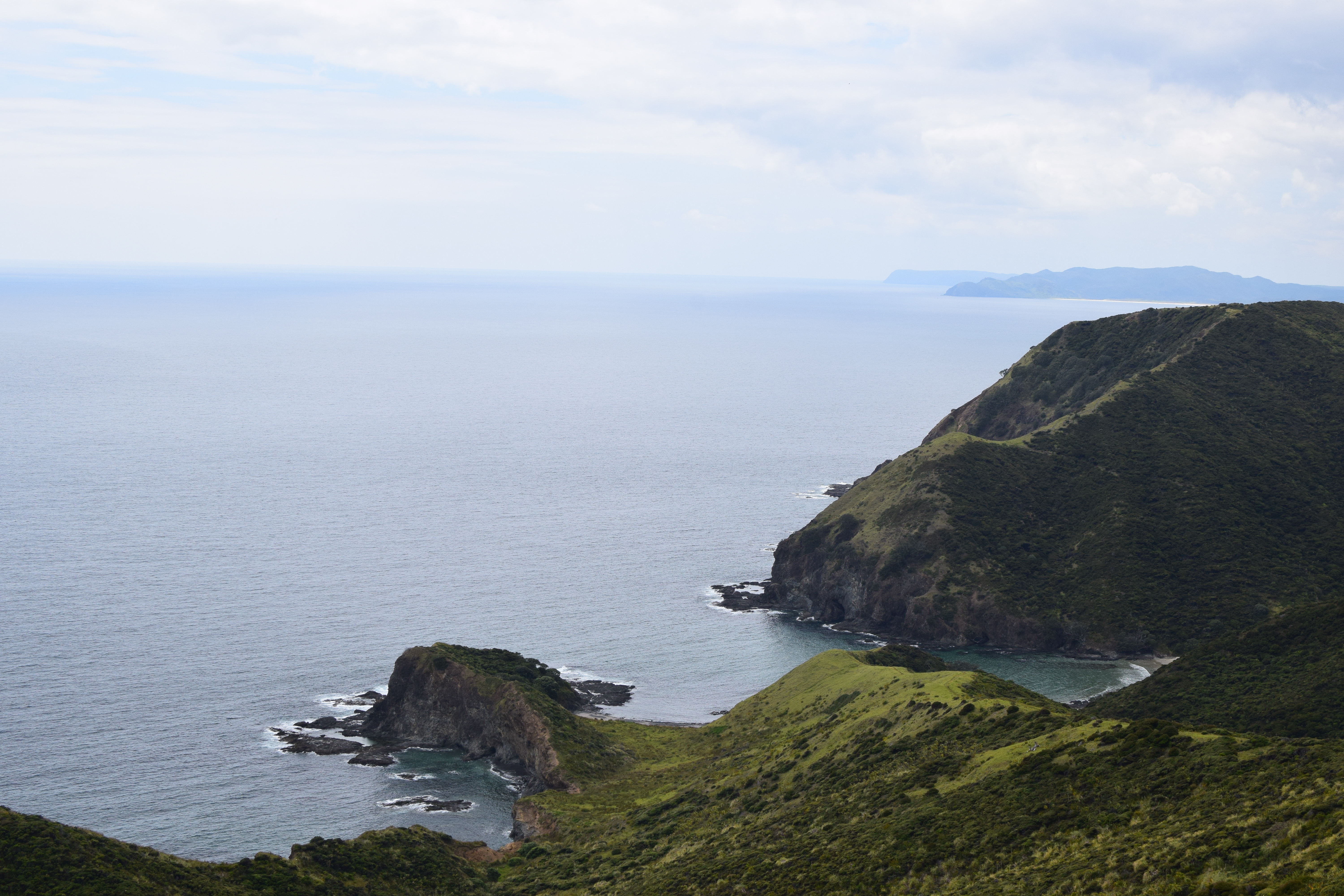
There are some amazing views to be had just from the carpark and the paved areas, however. I spent most of my time here looking contemplatively out to sea.
If you were to sail due North from this point, you might run into some small islands just North of the Equator, such as Butaritari or Bikati, which belong to the Republic of Kiribati; a country that is totally real even if it sounds like I just made it up. But if you happened to miss those, you would run into Attu Island, the Westernmost piece of land in America (despite currently being uninhabited and generally being a barren wasteland, Attu Island has a fascinating if brief history and in addition to being geographically distinctive is also the site of the only WWII land battle on United States soil).
I, however, did not make this journey.
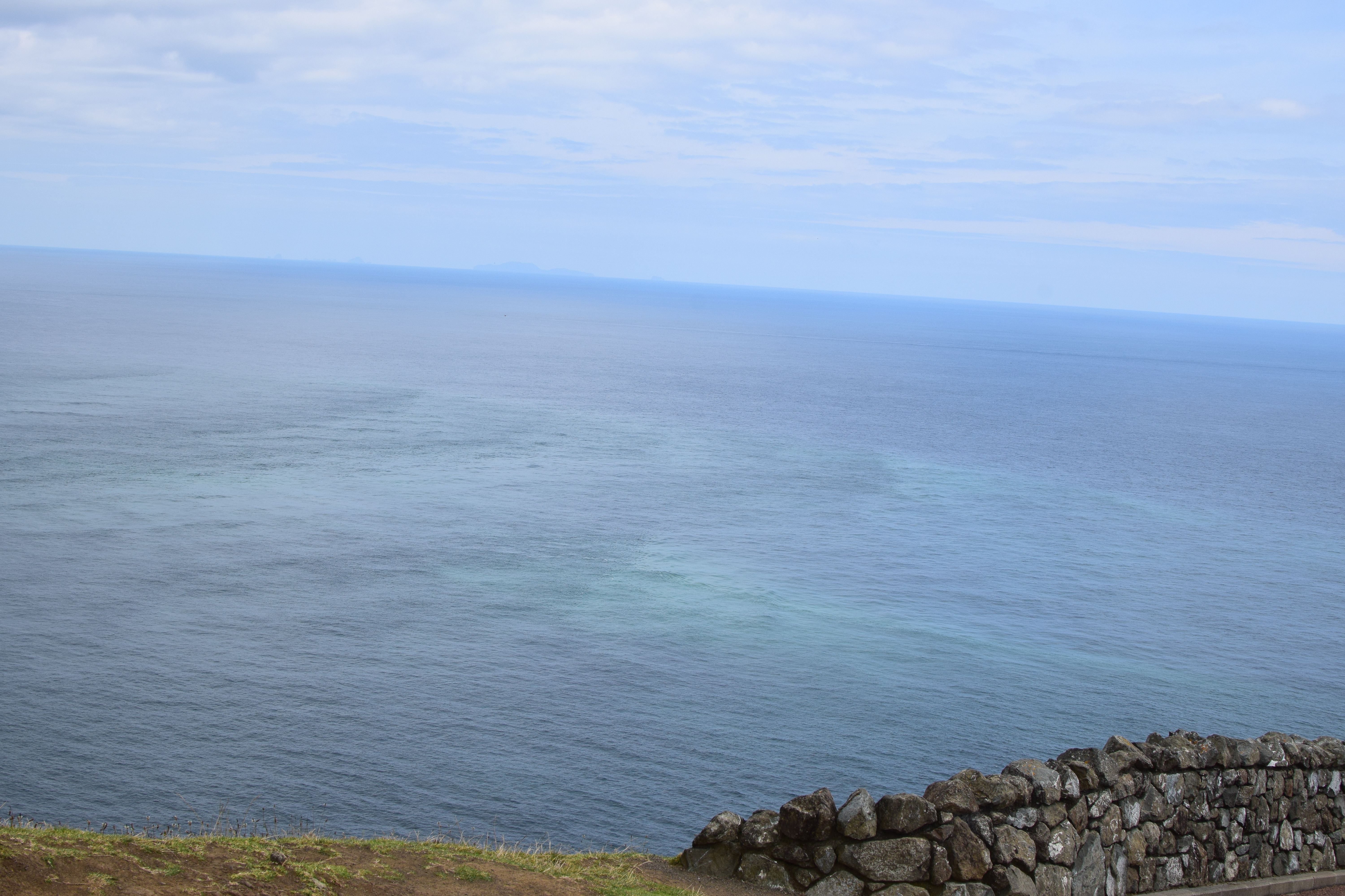
The waters of the Tasman Sea meet those of the Pacific Ocean here at Cape Reinga. This location is sacred to the Maori people, and it’s not hard to see why. Even on a chilly and somewhat overcast day, the water is gorgeous and almost luminescent.

Perhaps equally as famous as the signpost is the Cape Reinga lighthouse. It’s an easy, well-paved walk over to its base (where the signpost itself is), and lighthouses are unarguably very cool.
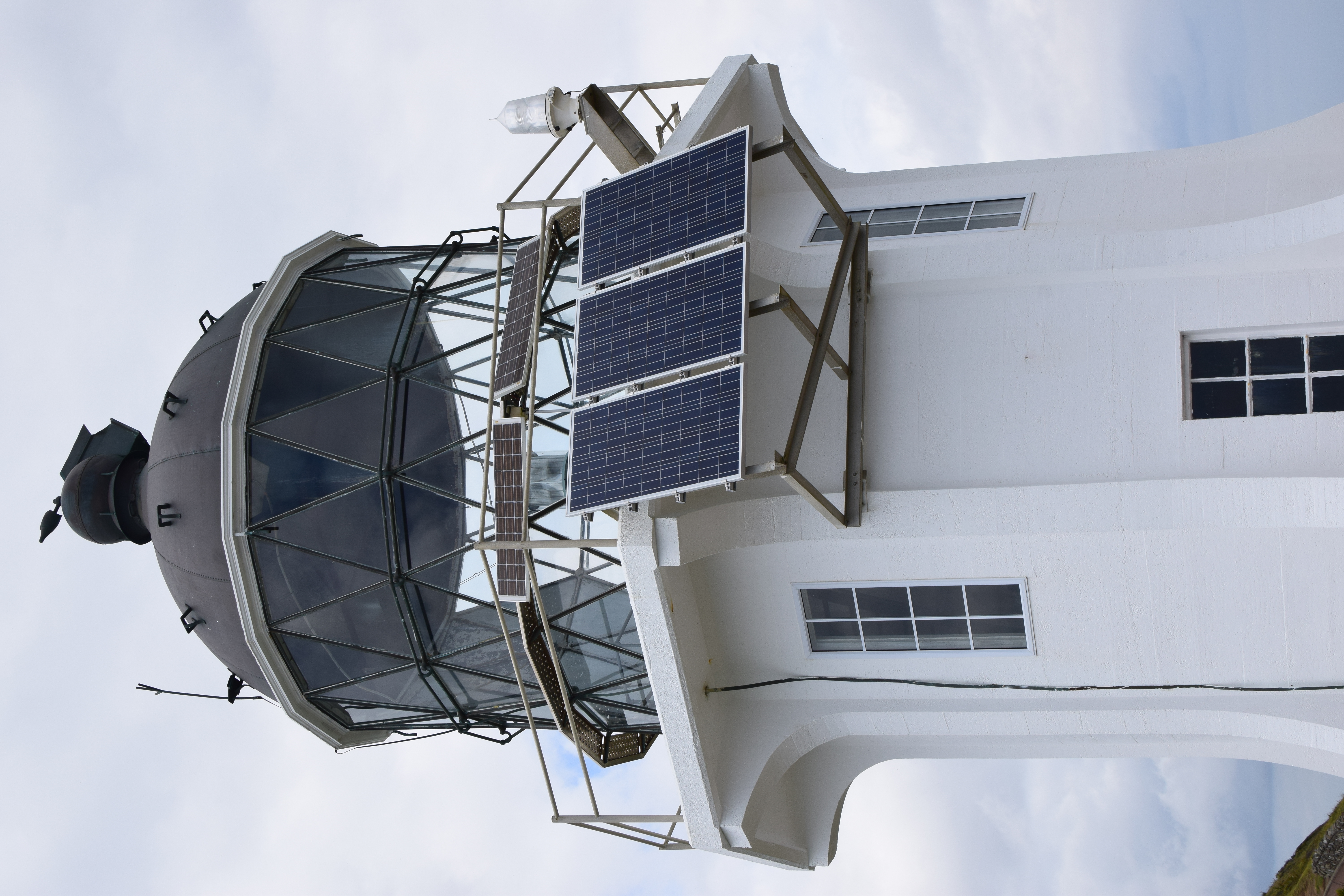
This particular lighthouse is automated and self-sufficient. Though it is a tourist attraction, it’s not just for show either. Its flashes can be seen 35 kilometers (nearly 22 miles) away, and it is operated by Maritime New Zealand as part of their network of lighthouses keeping ships safe.
You might expect me to have walked some of the trails and tried to access some of the more remote parts of Cape Reinga, but to be honest the cold weather plus the mass of tourists dissuaded me. Instead, I decided to go somewhere different.
Tapotupotu
If you head back down the motorway from Cape Reinga and turn off at your first opportunity, you will find the beachy haven of Tapotupotu.
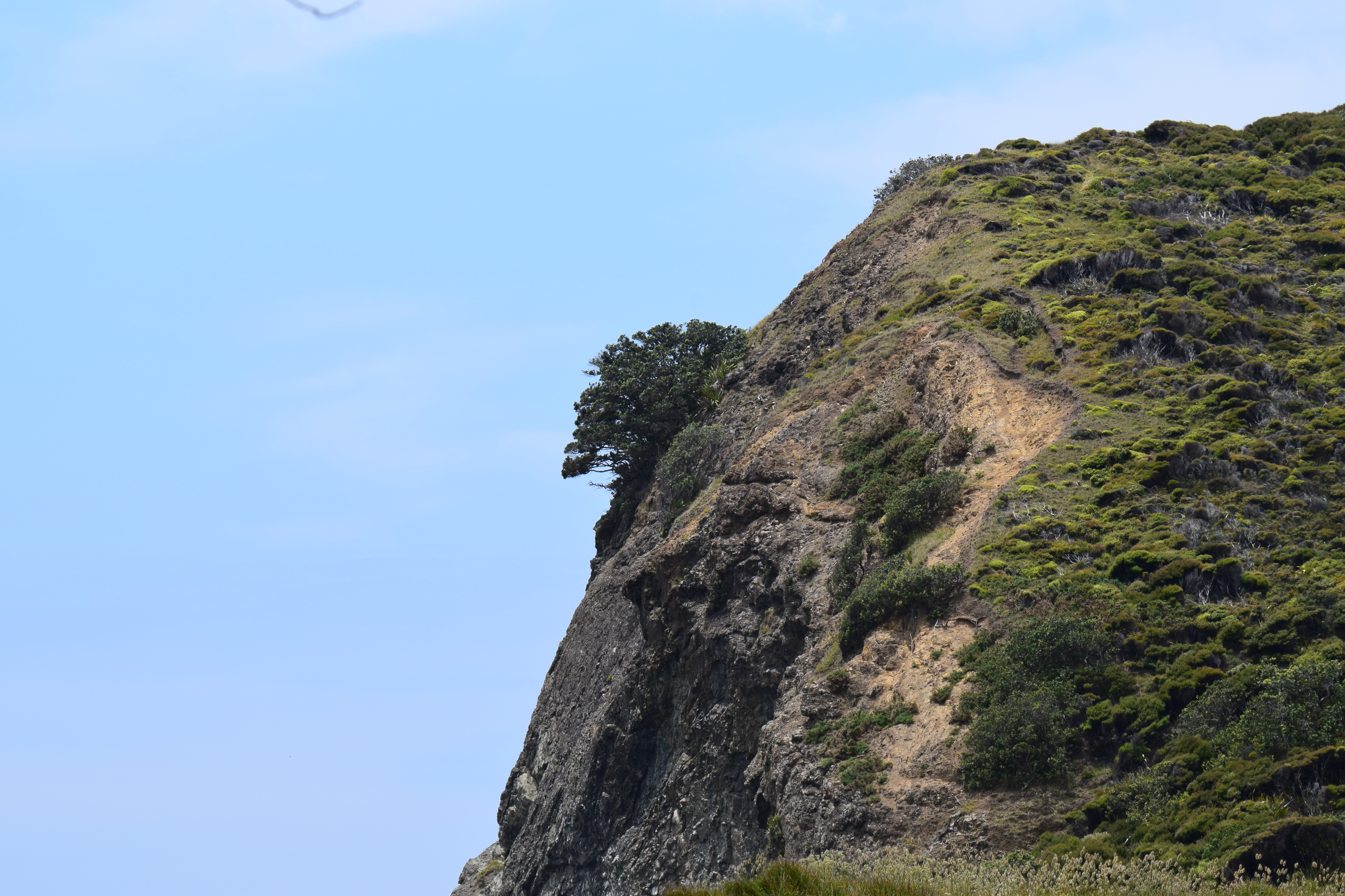
This small reserve and camping area is right at sea level, so it involves losing a decent amount of elevation from up on the Cape. Compared to tourist central up above, though, this little spot is relatively quiet.
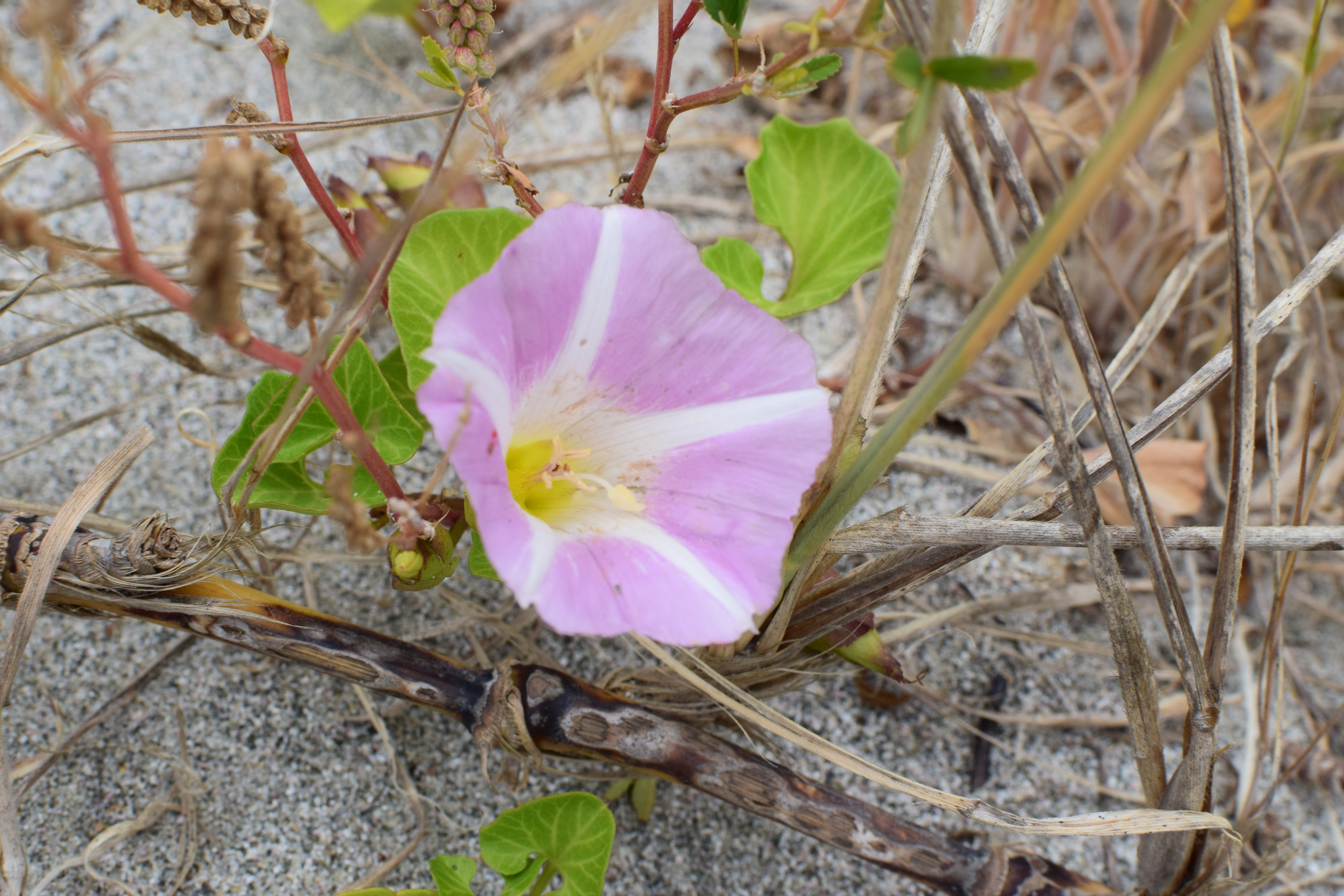
I could feel myself de-stressing almost immediately. I took the time to breathe, sit down, relax, and photograph the flowers :)
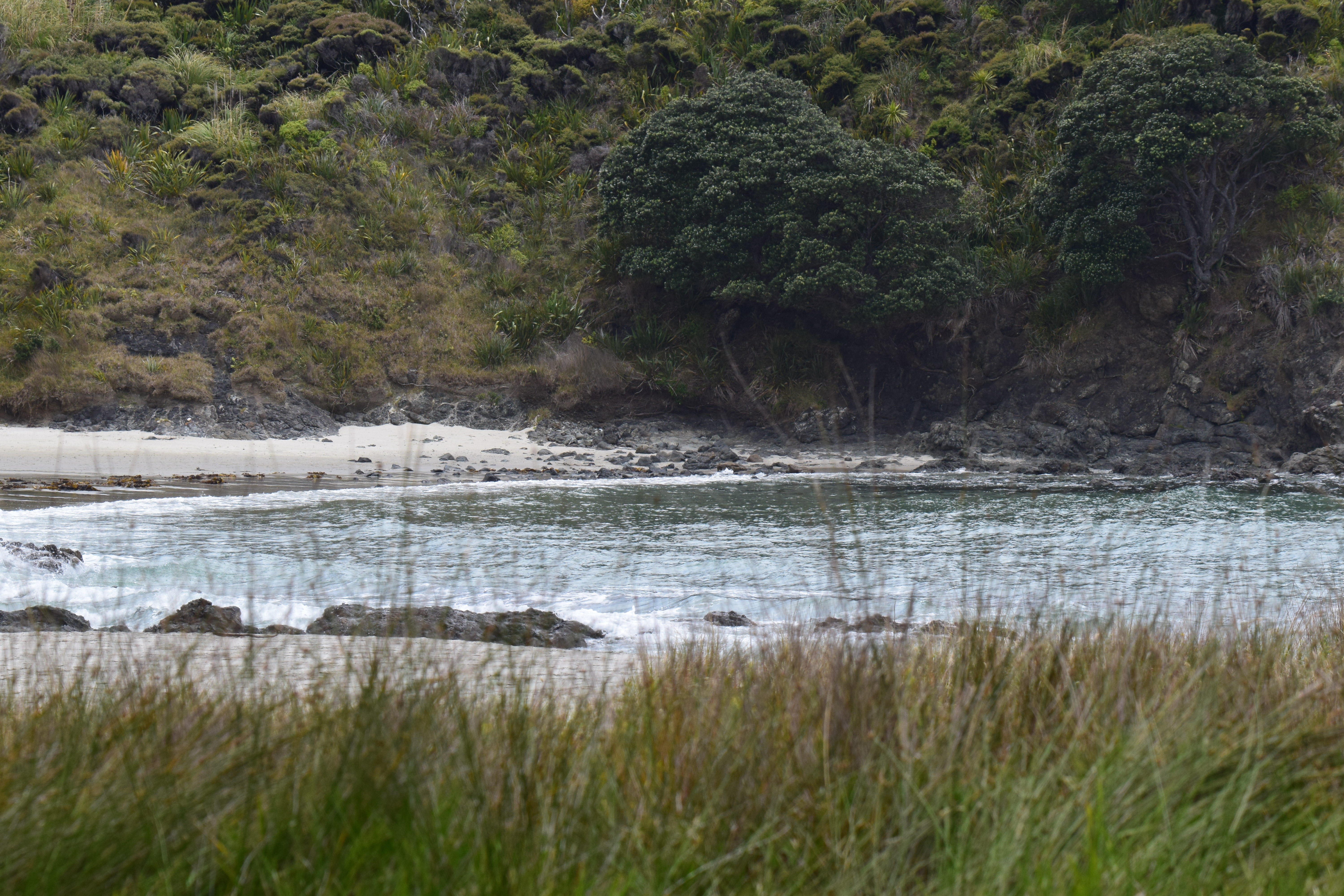
It’s not the most beautiful views of New Zealand, or even of this general area, but it has its own relaxing charm. Probably on a different day I would not give Tapotupotu a second look, but right then it’s exactly what I needed!
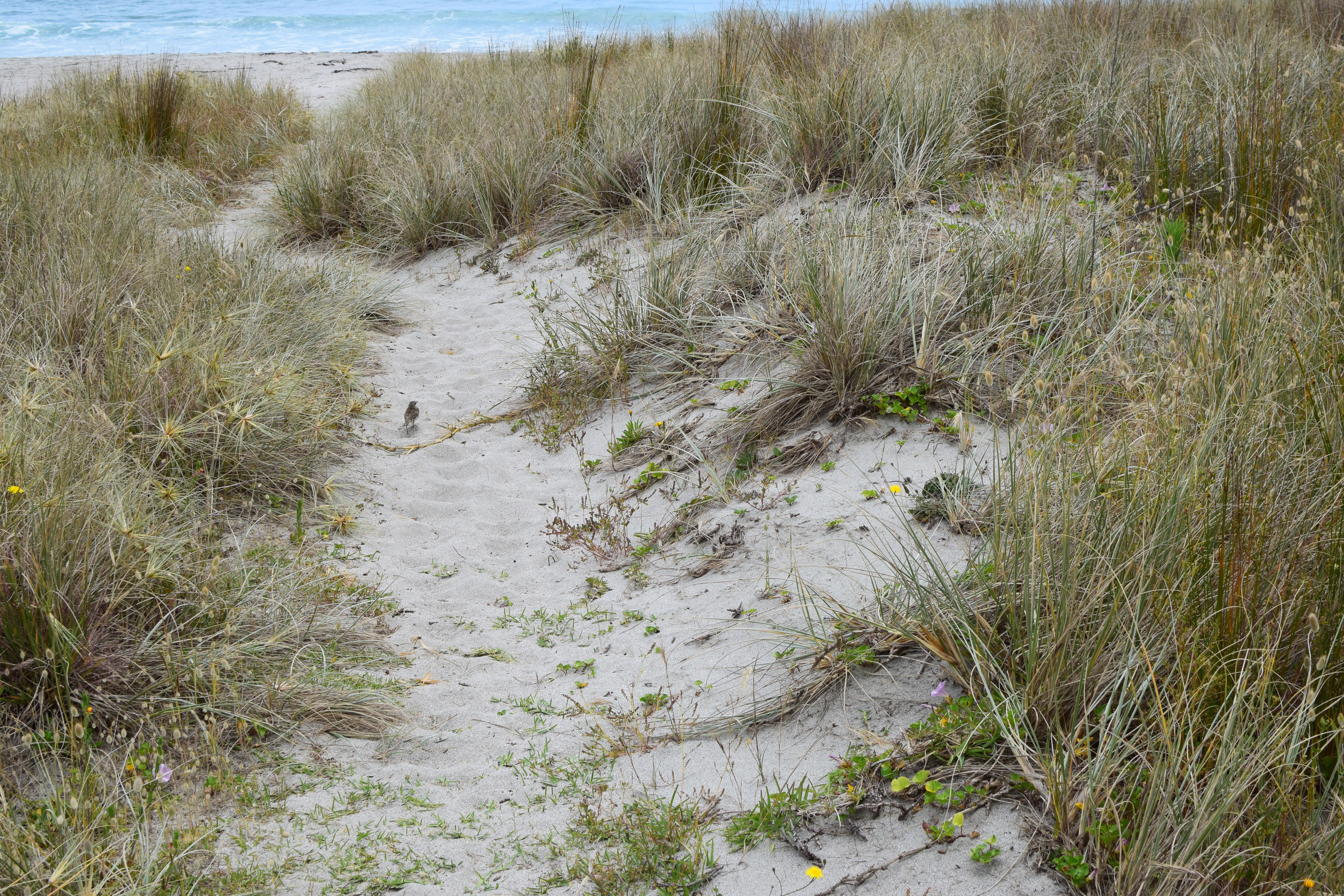
On this path to the beach, I noticed the small sparrow sitting on the path. I decided to sit down at a park bench and see what birds might land near me.
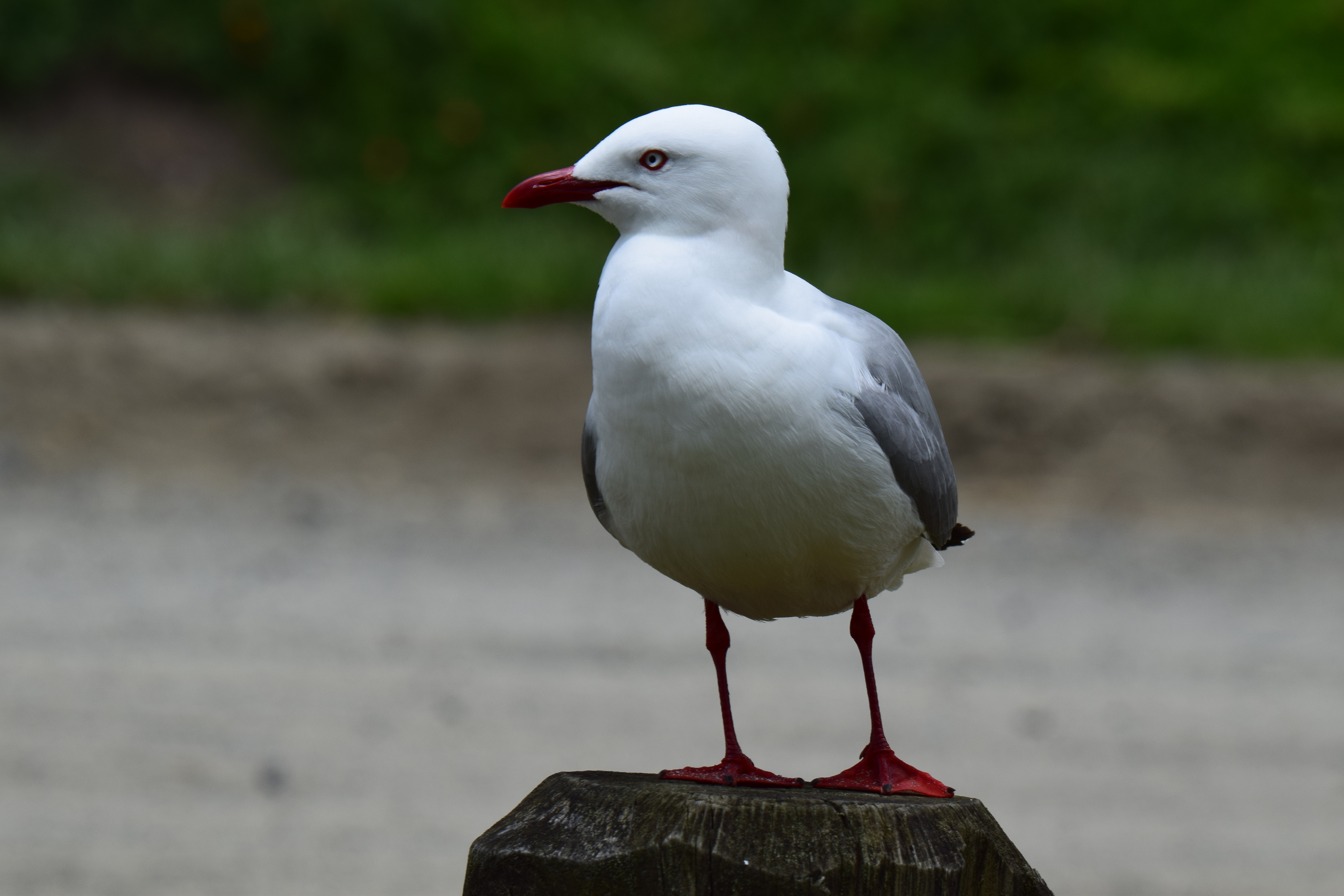
Nigh-immediately, this seagull plopped down close enough that I didn’t even need the big lens! Seagulls are loud and annoying and a bit gross, but they do have a certain appeal. Perhaps only because of what they signify: the proximity of the coast!

As I’m sitting and musing, a couple of these fine fellows alit on a branch.
I haven’t photographed one of these birds before, so let’s Zoom and Enhance(tm)!

Why, it’s a welcome swallow! These are native to Australia and surrounding islands.

I still have a ways to drive before my day is up. I found myself surprisingly reluctant to head back up these hills and back down South.
Cape Reinga is a sacred spot for the Maori people, but I found my peace here at Tapotupotu. I’m glad I went to Cape Reinga, but I’m even more glad I took the time to stop here and regroup!
Come join me next time as I start my journey back South. See you then :)
New Zealand Farewell Tour, Pt. 2: Russell, Haruru Falls, and Paihia
Welcome back! For those just joining, this is part 2 of my New Zealand Farewell Tour. I recommend starting at part 1!

After spending the night in Whangarei, I drove North to the small town of Russell. As you can see from the Google Maps shot above, taking Russell Rd over the hills is a bit of a squiggly experience. To be honest, I found little about the drive to recommend it: it was slow going and full of switchbacks, blind curves, and extremely poor roads. By the time I got to Russell, I was in dire need of a break.
Russell
Thankfully, the town of Russell provided precisely the respite I was after. Although it’s a very historically significant town (it’s the first permanent European settlement in New Zealand and its role in Euro-Maori relations was key in the development of the Treaty of Waitangi), it is a sleepy spot with fewer than 1000 residents. At this point in my trip, this was exactly my speed.
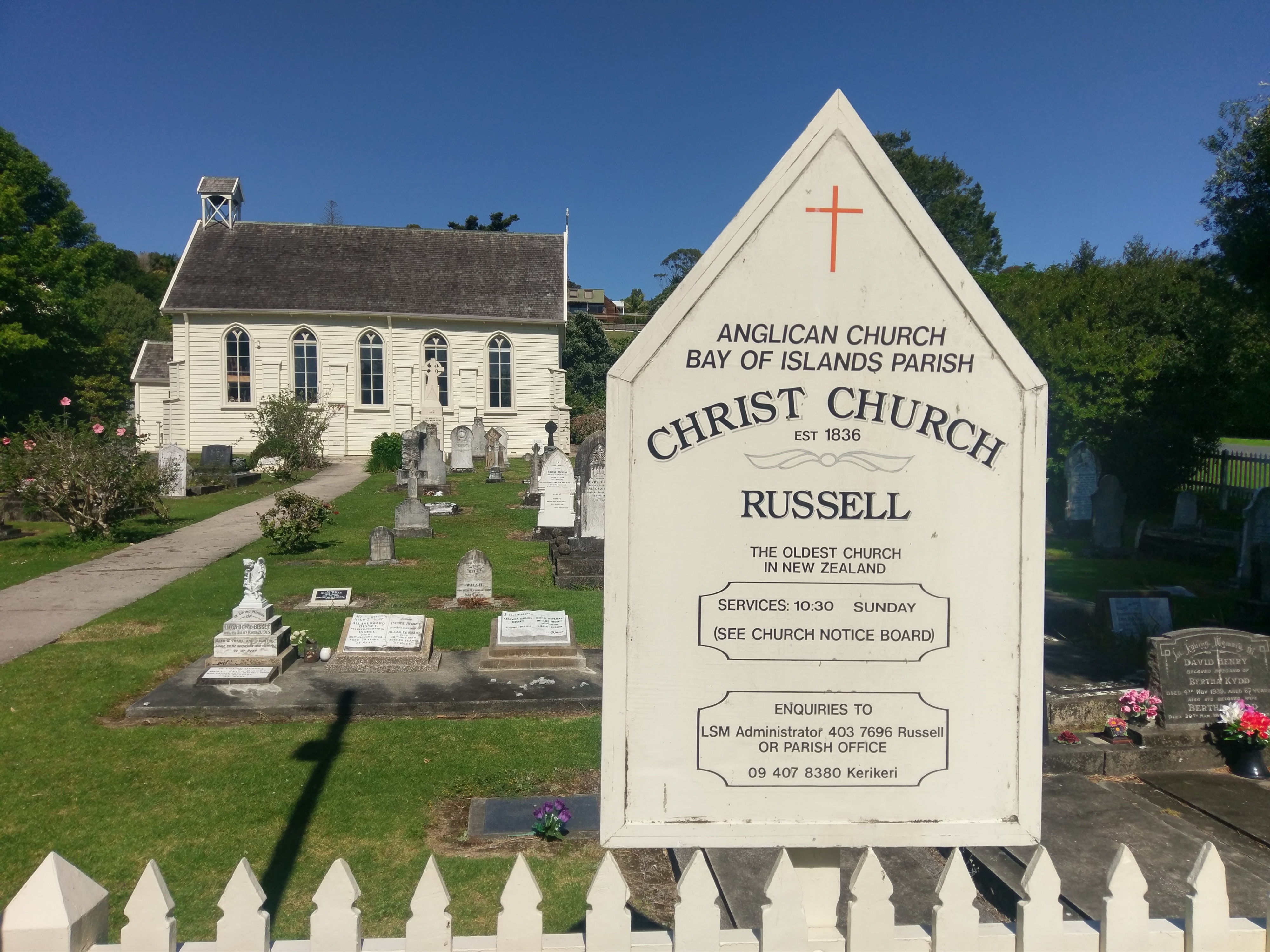
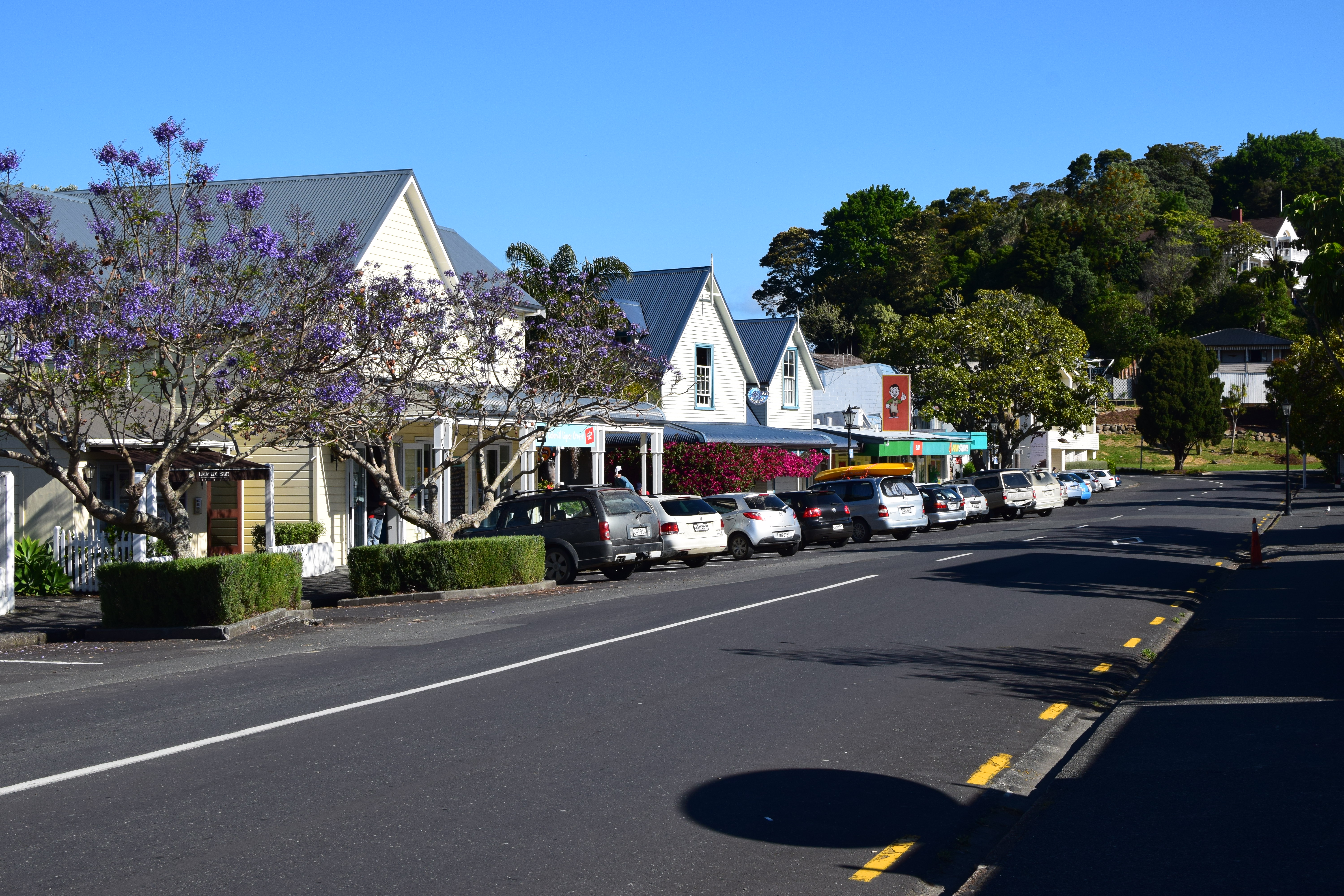
I took some time wandering around Russell, an exploration endeavor which can easily be completed on foot in less than an hour. One of my very few regrets in Russell is that I didn’t spend more time at this old church drinking in the serenity of this historic spot. It almost felt like I would be trespassing, though, so I chose to move on.
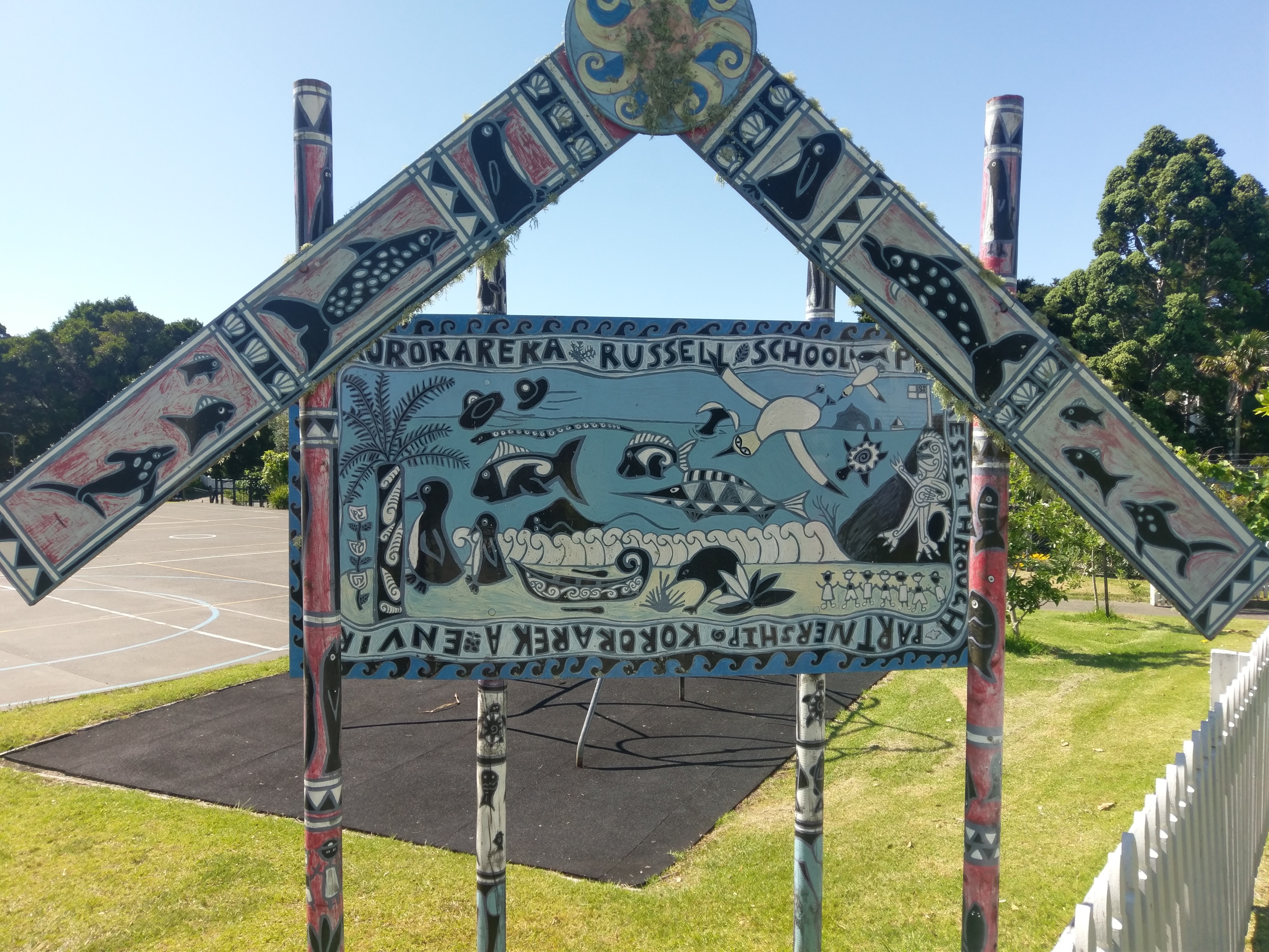
Russell’s sole school is, in fact, on Baker St, a fact I took much delight in.
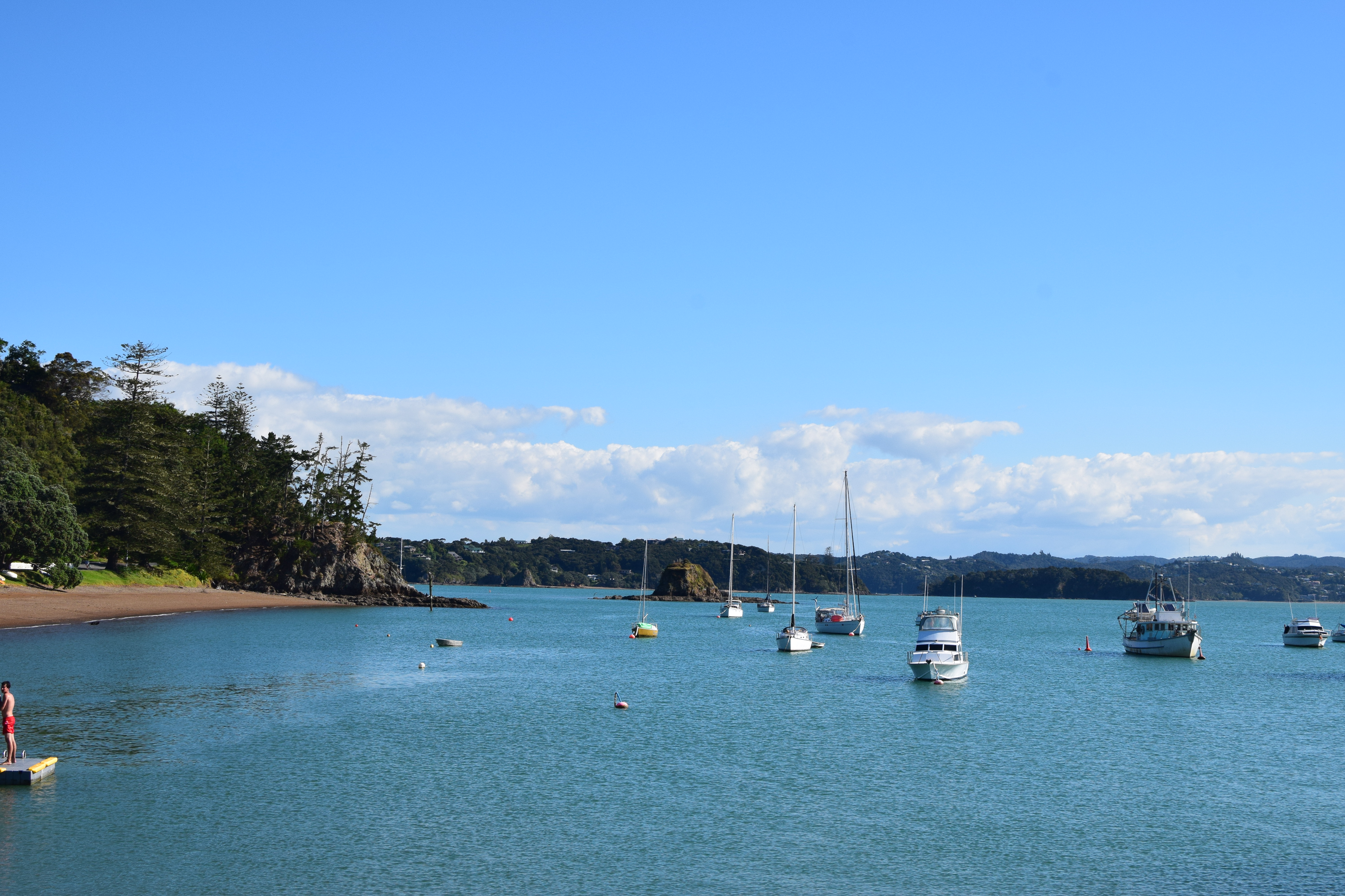
Russell is unsurprisingly home to a vibrant waterfront and marina.

I spent much time on and around the waterfront, enjoying the lovely late Spring day.
Normally I’d have been tempted to do more exploring, but the drive up was quite enough adventure. I was also acutely aware that my day’s journey had not yet ended. Russell was my lunch spot, not my final destination for the day.
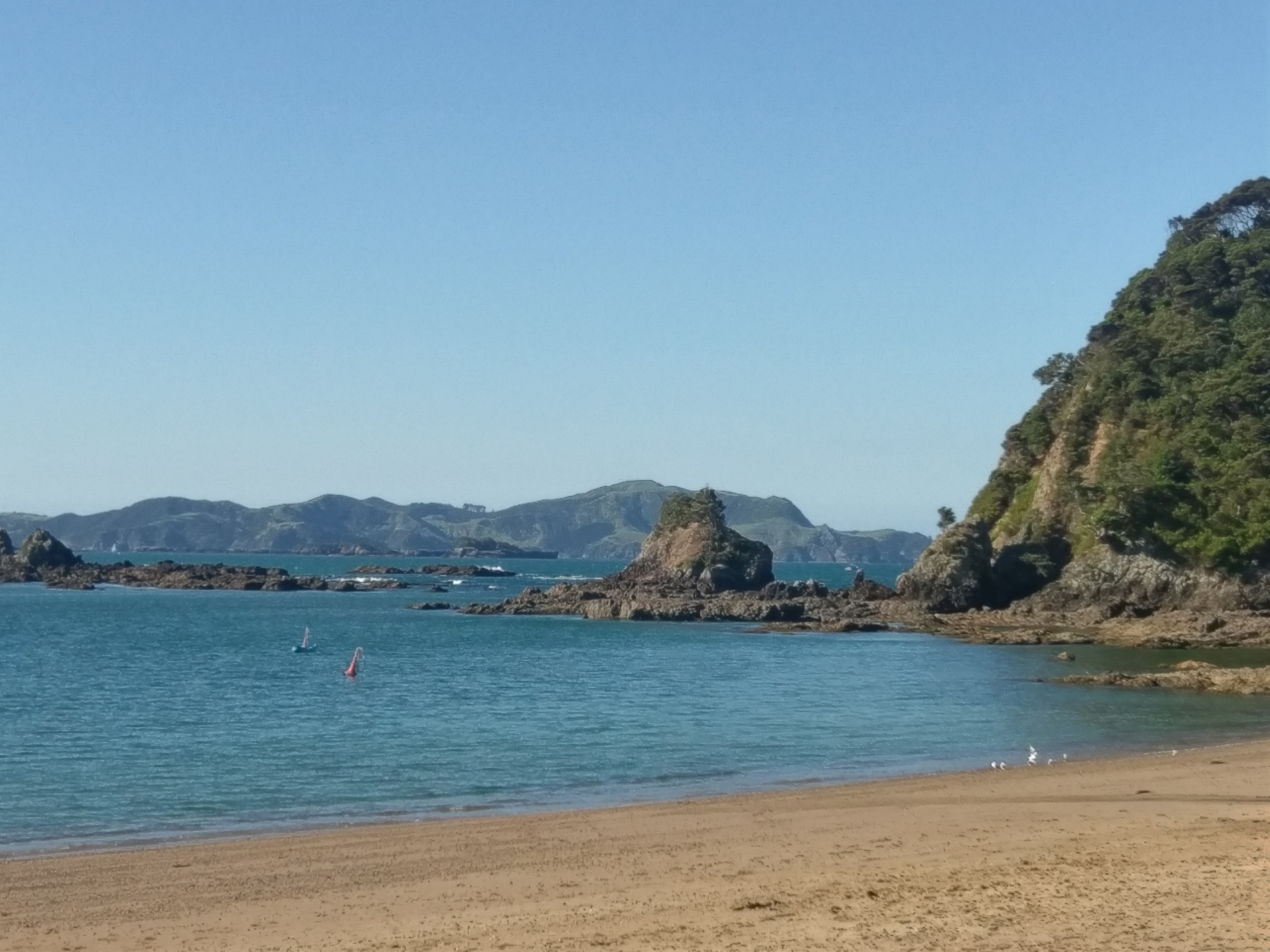
Nonetheless, this rock outcropping looks like it would be a lovely spot to venture out to.

All in all, I had a delightful time in Russell. I found myself quite reinvigorated and ready to start the next leg of my journey!
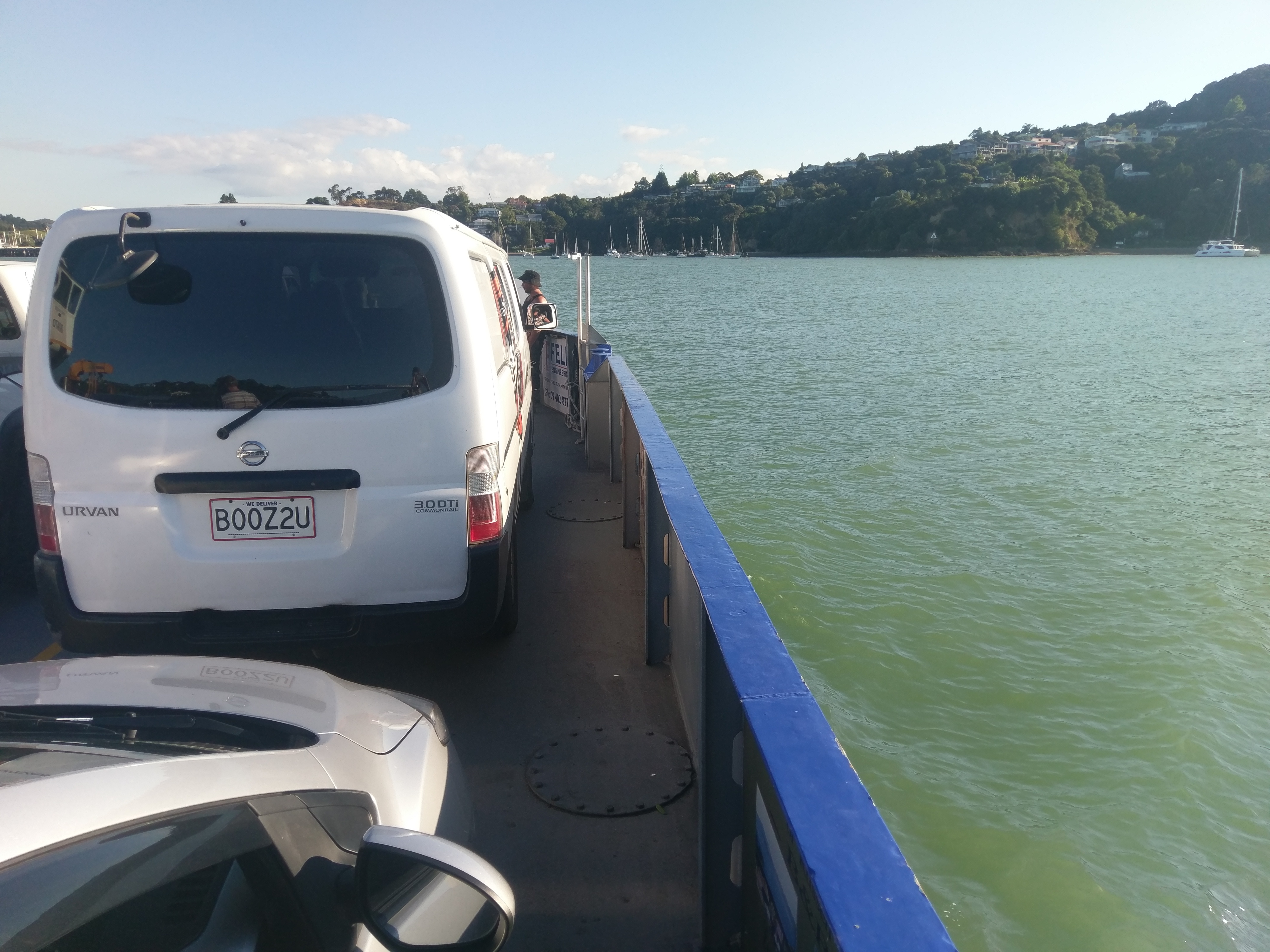
I also found something which, at the time, nearly brought me to my knees in thankfulness: a car ferry. A quick drive down to Okiato led me to a quite cheap car ferry which took me over to Opua. From there it was a mere doddle over to my final destination for the day: Paihia.
Thanks to this car ferry saving me time, energy, and perhaps my life, I had time for an unplanned stop: Haruru Falls, outside of Paihia!
Haruru Falls
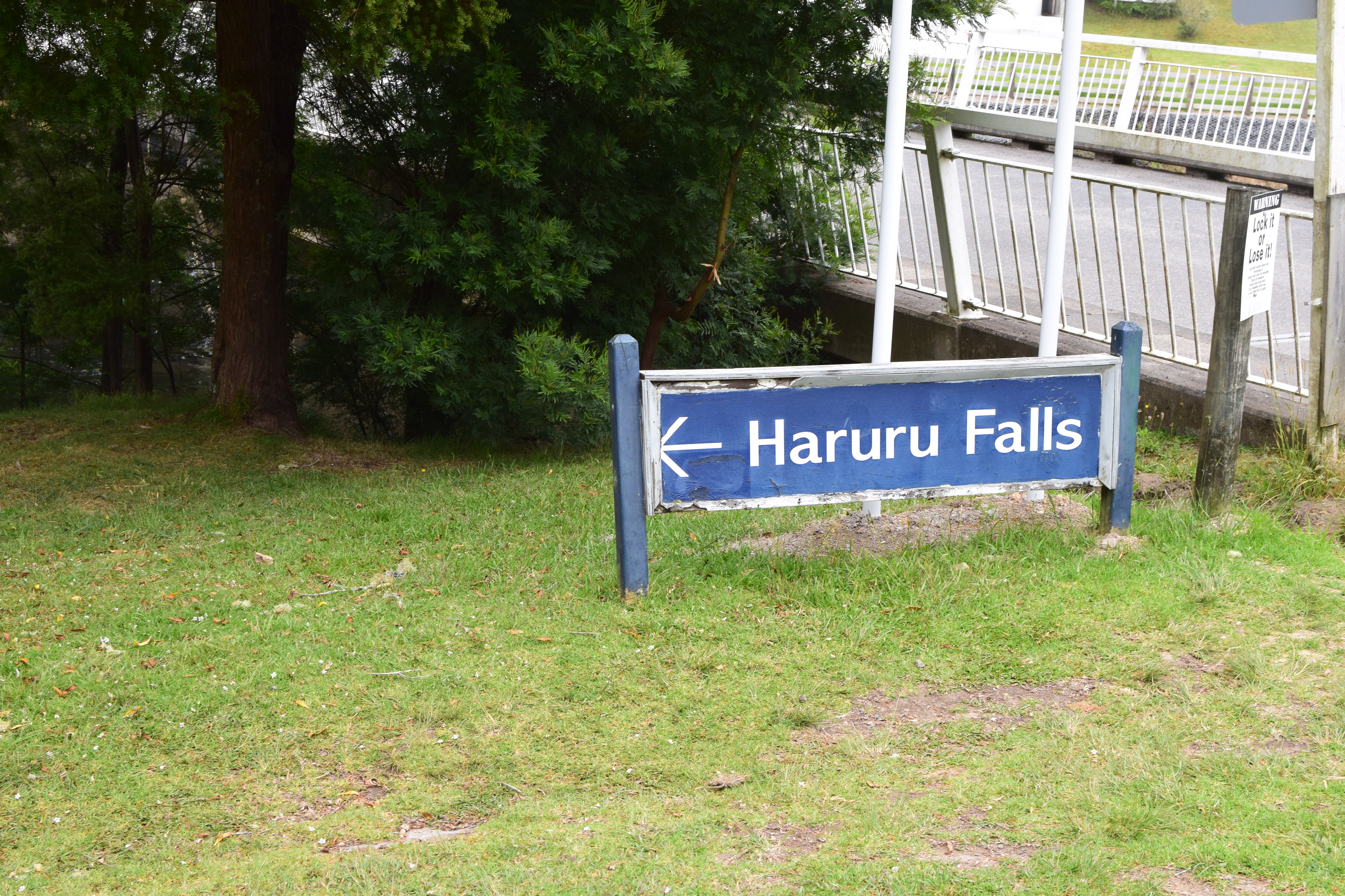
Haruru Falls are just a short drive away from Paihia, a location which we shall visit anon. They’re right off the motorway, so no real need to do a lot of hiking to get there.
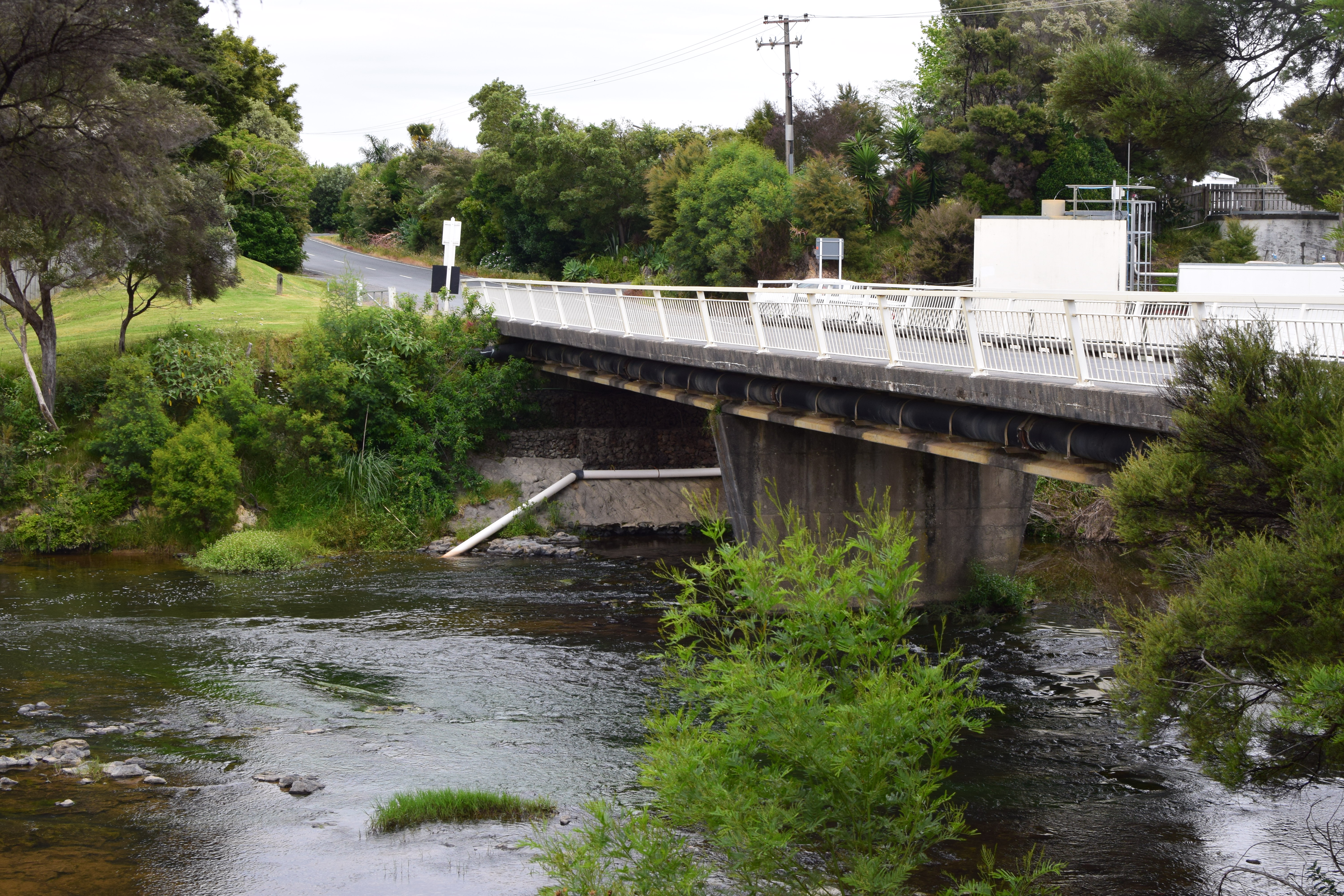
The accurately-named Haruru Falls Rd. goes right over the Waitangi River.
This river flows slightly down from the bridged crossing. There’s a convenient carpark on the North bank of the river for those wishing to access the falls and / or the Waitangi Track.

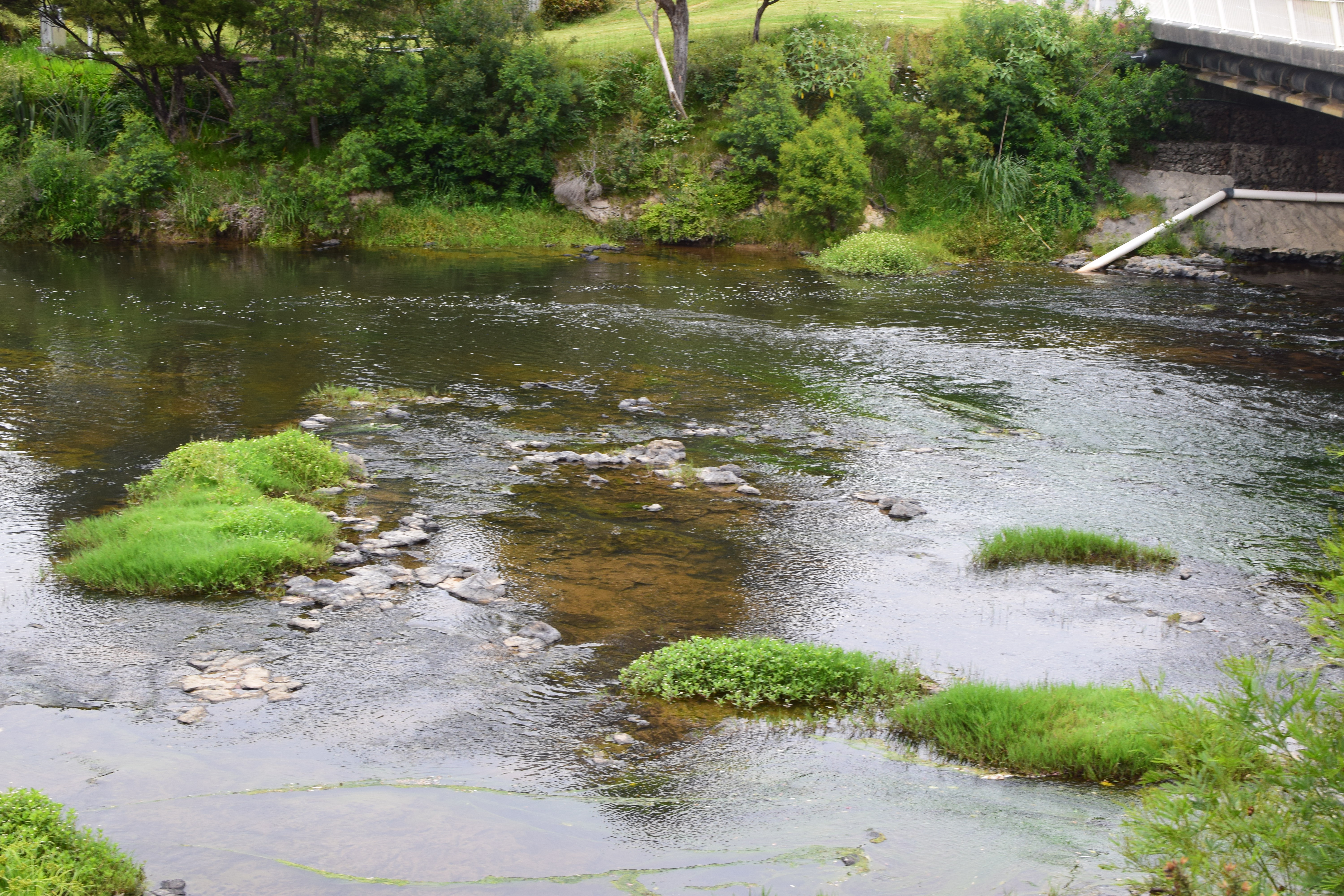
The river reaches a dropoff point just several meters from the bridge, creating these spectacular, if somewhat small, waterfalls.
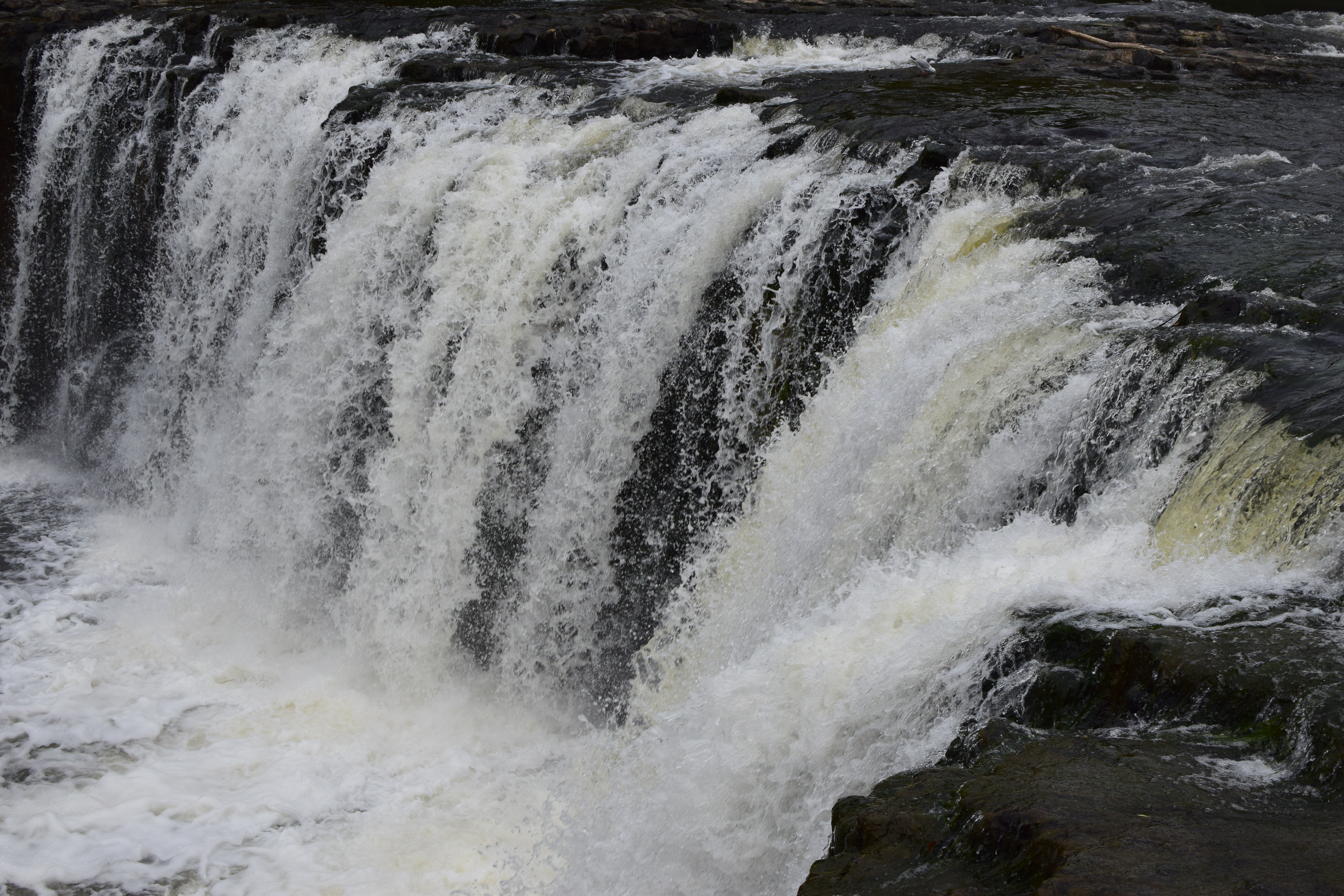
These falls are a nice sight, and will take less than an hour of your time if you are already in Paihia!

The Waitangi River broadens somewhat after the falls and meanders off to the town of Haruru, from which the falls draw their name.
Paihia
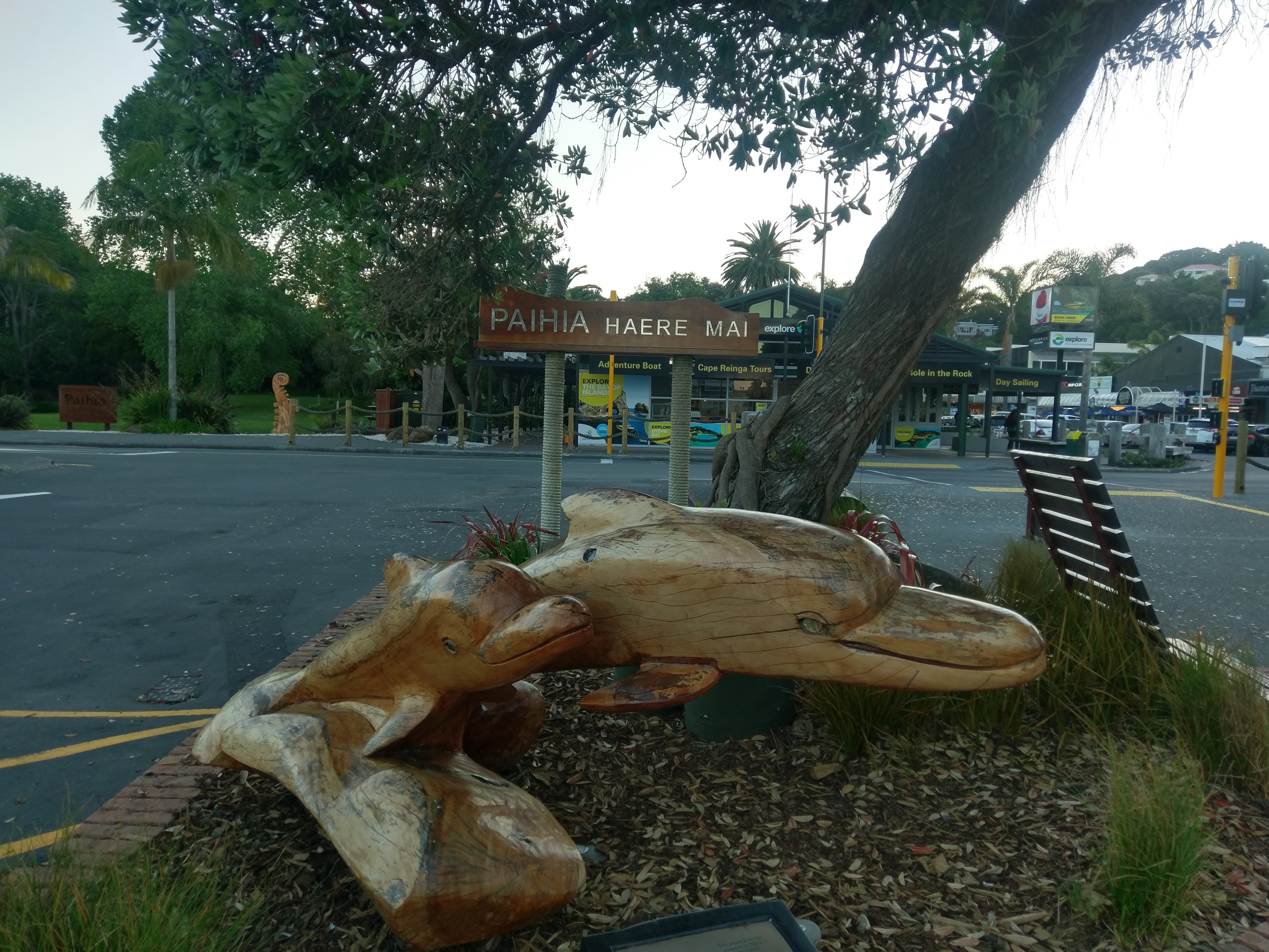
The small town of Paihia is a popular destination for tourists and locals alike, but in November the tourist season hadn’t yet entered full swing. Fine by me; I got some nice weather without having to battle intense crowds!
(Haere Mai means Welcome in Te Reo, the Maori language).
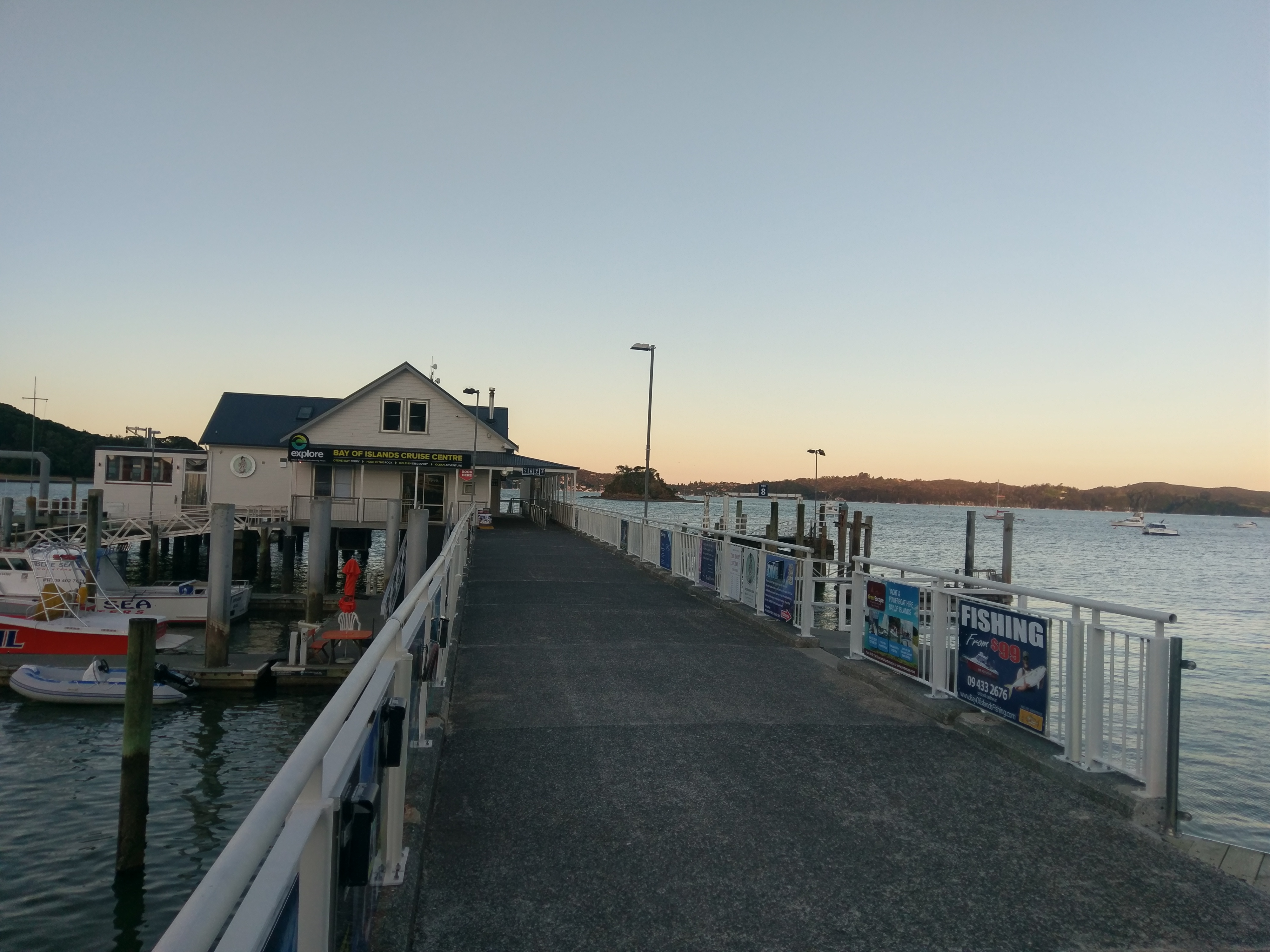
I arrived as the sun was getting low in the sky. I ate dinner at this restaurant at the end of the pier, giving a fantastic view of Te Ti bay.
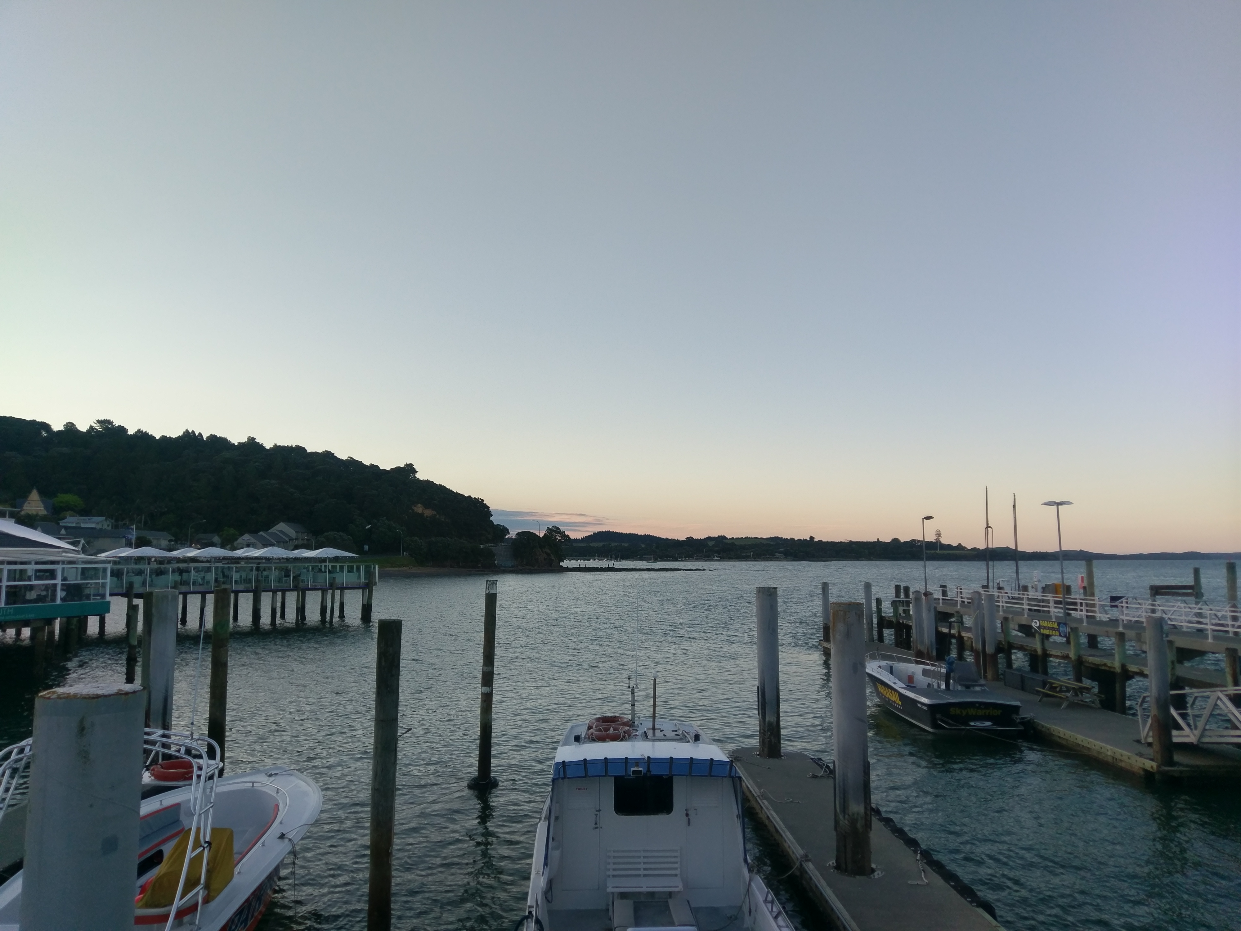
The area around Paihia and Russell is called the Bay of Islands, for reasons that become apparent when looking at a map or nautical chart. It is an incredibly beautiful area, and after dinner I took a walk and got some fantastic views. This time of year it seems like it takes ages for the sun to set!

Paihia has some nice statues and sculptures, including this one of what I guess is a swordfish. I really love this shot!
Once I was showing this photo to a friend, and he thought I had actually caught a swordfish leaping from the water! I wish :)

Eventually, the sun did fully set. I walked back to my hotel (pretty much everything is walking distance in Paihia). This day, November 23, happened to be Thanksgiving Day in the US. I spent some time sending messages of goodwill to people that I love and making sure I let my friends and family know I was, and am, thankful for them.
It was a good way to end what, despite a harrowing drive, was a good day. I need to end more days letting loved ones know how thankful I am for them.
If you have read this far, I’m thankful for you too! Join me next time as I make it to the tippy-top of the North Island!
New Zealand Farewell Tour, Pt. 1: Matapouri and the Mermaid Pools
The Road goes ever on and on. Late in 2017, it became apparent that my Road was leading out of New Zealand and back to the United States. This Road would lead me to many wonderful things, including that most elusive of all the phantasms crowding our hearts: love.
The joy and sadness of the Road is that glances forward may be full of promise, but glances backward deepen the sorrow of parting. It has been difficult to write the tale I am now preparing to tell you, as these backward glances have reminded me of some of the best times of my life.
I am heartened, though, by the strong belief that truly the best is yet to come. And this belief, accompanied by what my eyes have already seen to validate that belief, has heartened me sufficiently to take my metaphorical pen in hand once more and tell you the story of my last great adventure in New Zealand.

My goal was to drive North until I ran out of road at the Northernmost point of the North Island: Cape Reinga. There were adventures, planned and unplanned, both on the way up and on the way back, but for now I will tell the tale of my first stop: Matapouri.
Matapouri is a beach slightly North of Whangarei, where I spent the first night of my trip. As you can see, it is a very pretty location! It’s a white sand beach with lovely warm water. There’s a decent carpark and also a convenience store if you forget your sunscreen, as I did.
The smallish beach wraps around a cove, cleverly named Matapouri Bay. Let’s Zoom and Enhance(tm) on the far side…
There’s a cool little semi-island there! Normally I would have made my way out there (either by swimming or picking my way along the little isthmus that connects it to the beach), but I had a different target in mind, and was running out of time!

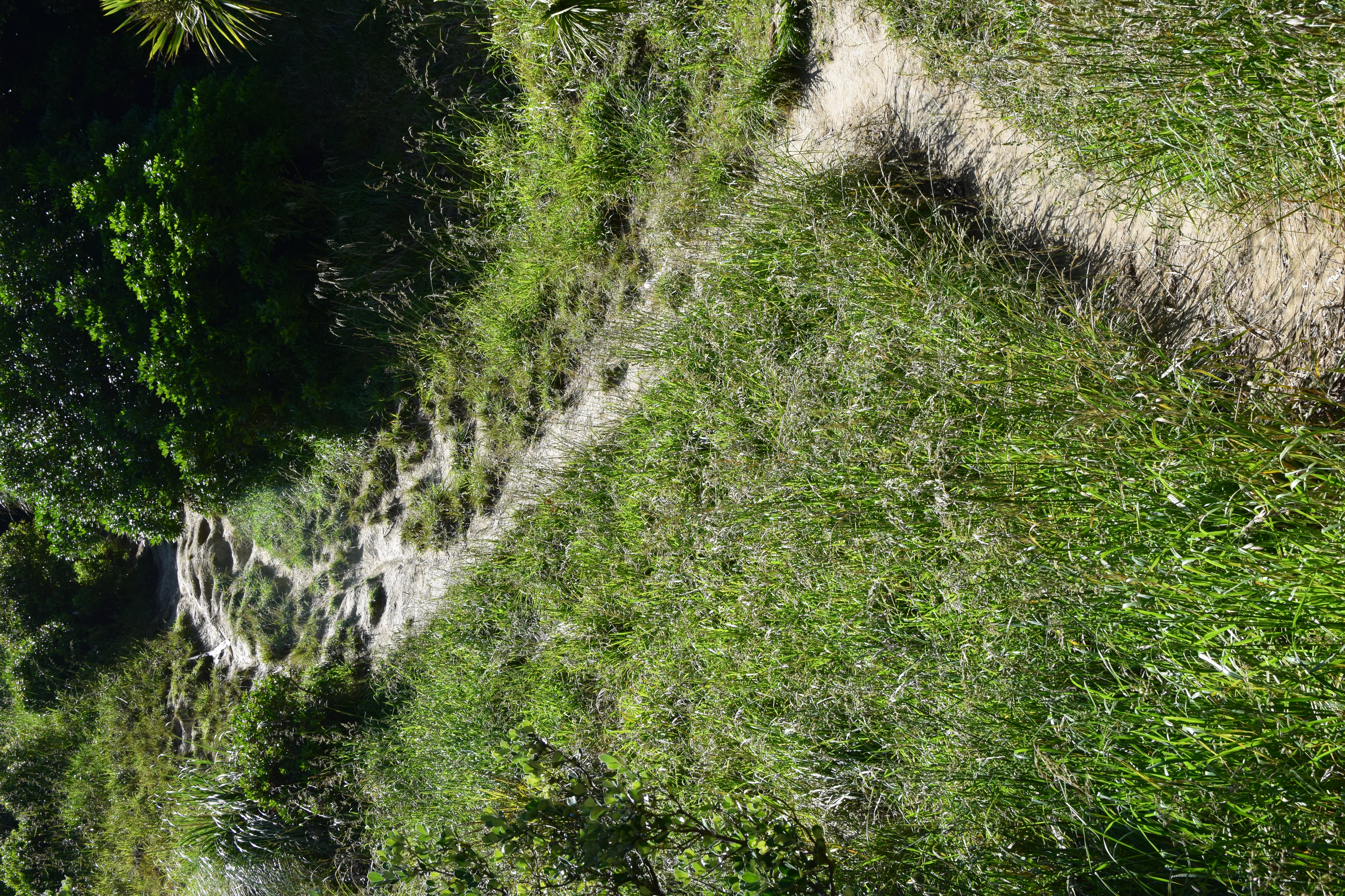
If you look across the bay, there’s another small sandy beach between the two hills. You can’t really see it from the photo, but there’s actually a walking path that runs up and over the hill starting from that beach. This path leads to the Mermaid Pools.
The Mermaid Pools are only accessible by land at low tide, which it most definitively was not when I arrived. And the tide was coming in, so the path was becoming more and more submerged by the minute. I decided I was very much interested in seeing the pools anyway, so I made my way around the beach as far as I could.
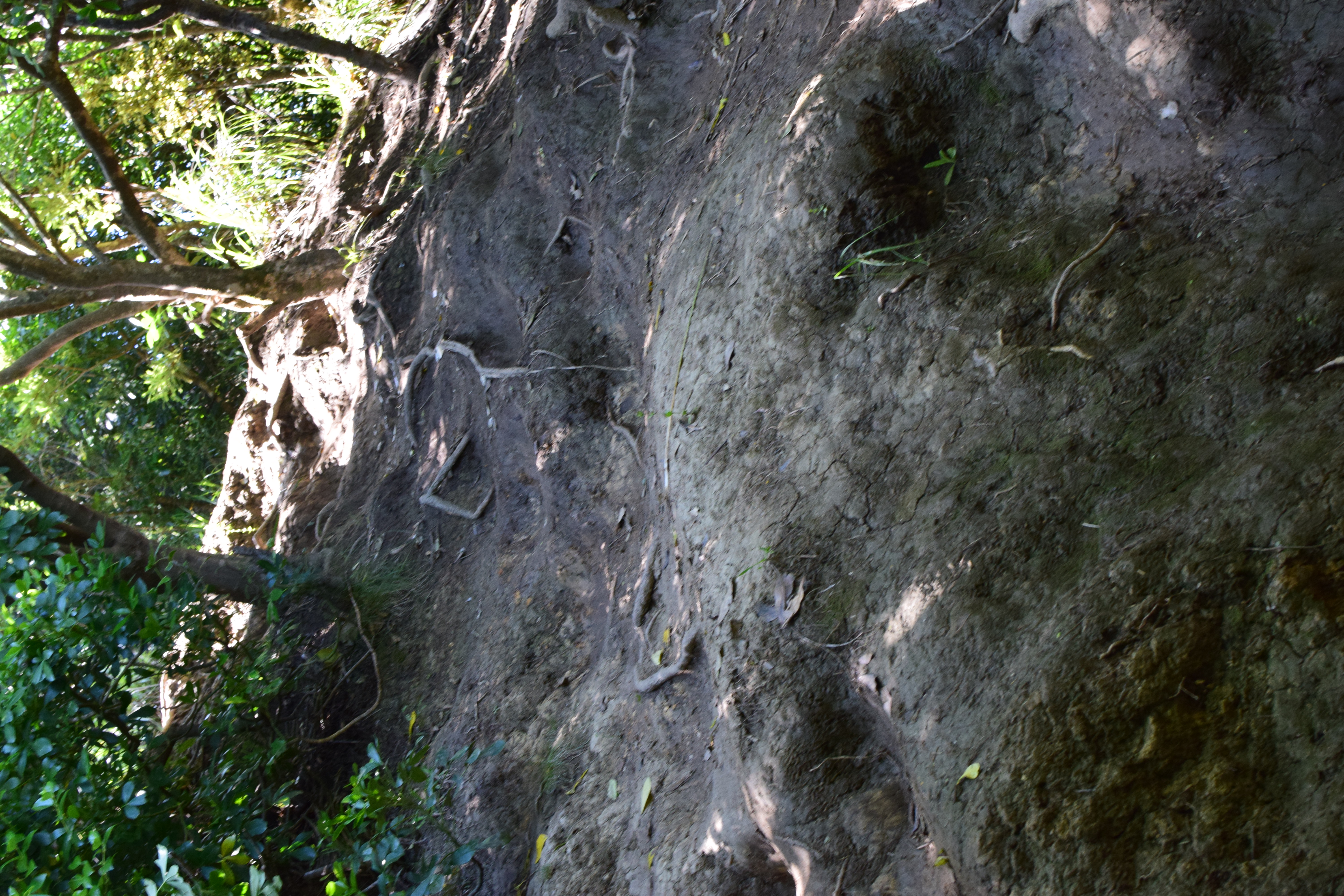
After struggling through a very gross area full of rotting seaweed, I finally arrived at the point in the photo above, where I could no longer walk. My options were swimming out into the bay around the rocks and then back in to the beach or climbing along the rocks.
Unfortunately, I had not made the wisest choice and had a) not changed into my swimsuit and b) brought all my stuff with me in my pockets. So I did what I would never be able to do in America and emptied my pockets (including my cell phone and car key) onto a (hopefully) secluded rock, one high enough up that it wouldn’t be submerged by the incoming tide. And then, holding my camera above my head, I waded in to climb on the rocks and wade through the water.

Eventually, I did make it to the beach! I did horribly scrape my leg at one point where I slipped and my shin hit a rock. One year later, the scar is still (barely) visible. But I did make it, camera intact — as this photo of the beach that I started from does demonstrate!
This is the photo of how I got over there: climbing up and around these rocks. Somewhere on the other side of that outcropping are my keys, phone, and wallet.

And this is my goal: this path going straight up the hill!
NOTE: Please see the important update at the end of this post for the latest on this trail!
I’m making this trip in late November, so it’s still Spring in New Zealand. By the end of Summer I’m sure this path will be well-cleared by the feet of a thousand tourists. But for right now, it’s looking a bit overgrown.
Of those thousand tourists, a few may well turn back here. The path becomes little more than a free climb up a steep dirt and mud embankment.
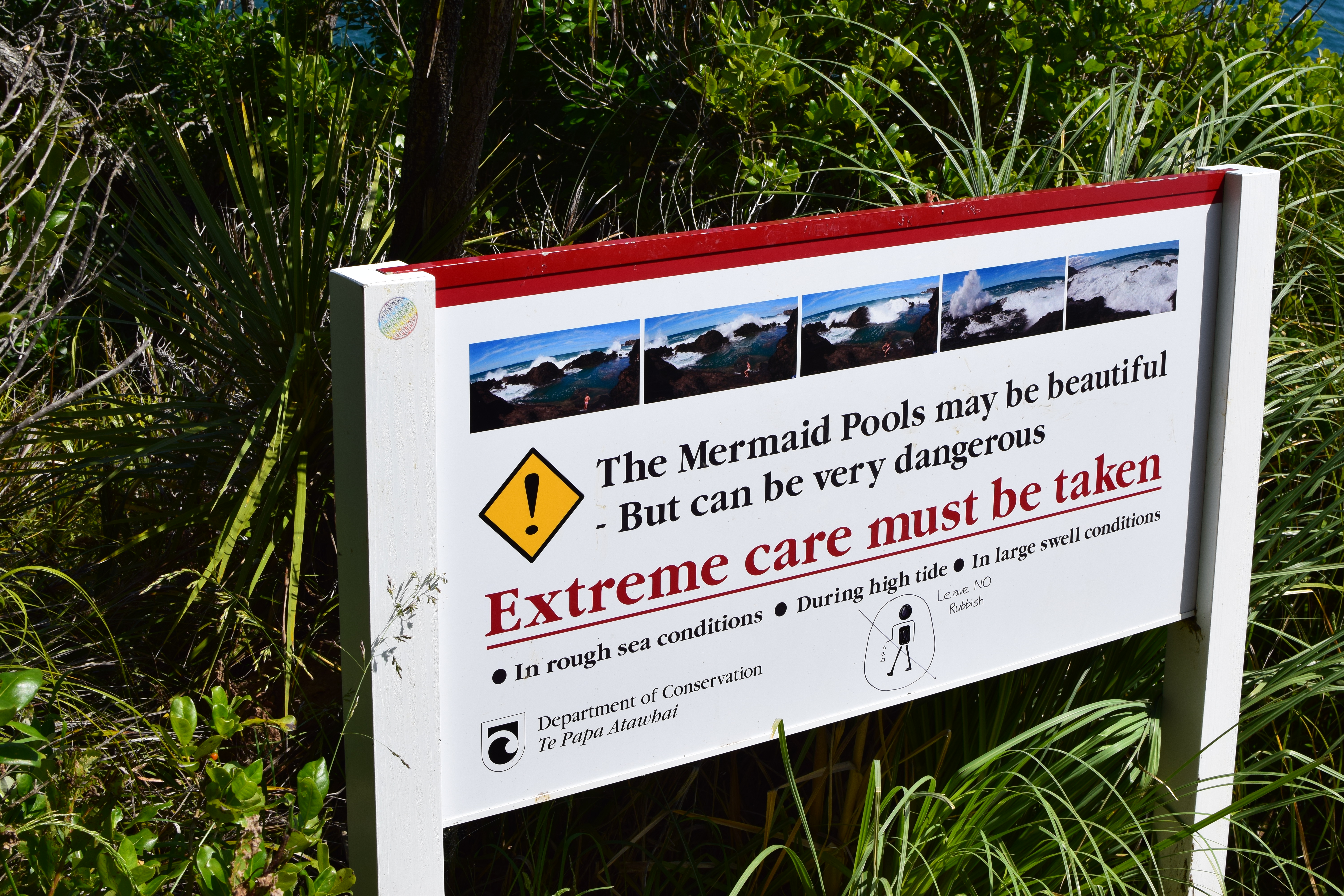
Before reaching the pools, there’s a sign telling visitors to be very careful. The photos along the top are a very amusing series of images depicting a tourist surprised by a large wave and fleeing before his vantage point is completely flooded.
In case you think this sign is overly cautious, a quick search for “mermaid pools NZ” will produce plenty of articles and blog posts about people who got themselves into quite a bit of trouble. It’s very worth being careful.

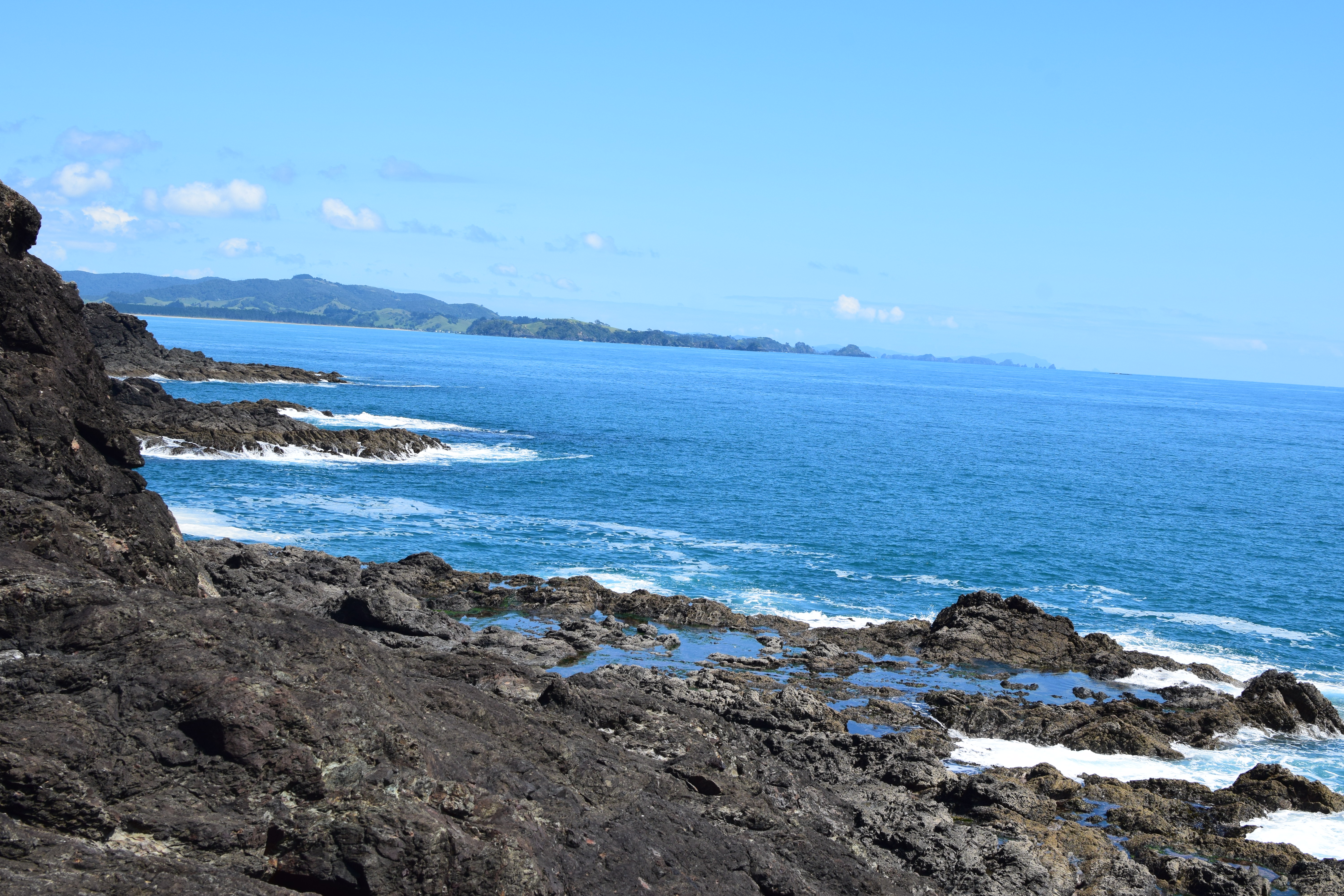
As I crested the top of the hill, I could see why people made the trek and braved the ocean’s wrath. This is a very beautiful spot!

From the top, you can barely see the eponymous pools.
Amusing side note: upon arriving at the pools, I encountered a couple who had gotten there before me. They seemed somewhat annoyed to discover that someone had braved the high tide and come to visit the pools. I think they had come over at low tide and hoped to have the place to themselves. Sorry, folks! I at least tried to do them the courtesy of keeping them out of my shots.
Climbing down near to sea level, you can see some more small tide pools. But it’s not these that give the place its name.
No, the Mermaid Pools are quite large; this one is bigger than a bathtub. I was able to fit my whole body in it and lounge around quite comfortably.
Here’s a slightly closer-up shot to show how clear the water is! I do confess I got some of my blood in the pool as I soaked my wounded leg. The salt water did help the cut a bit!
(Photography note: the only lens I had with me was my 35mm, since I didn’t bring the whole camera bag for hopefully obvious reasons. Any “zoomed in” shot is from me moving the camera closer!)
As I bade the pools (and the couple, who were now pointedly ignoring me) farewell, I encountered a group of young German tourists coming down to the pools. I felt less bad about disrupting the couple’s alone time, as they were about to be disrupted anyway. I also felt slightly less adventurous making the trip over to the pools at high tide, though they were suitably impressed that I had gotten my DSLR camera over with me.
Upon reaching the summit of the hill again, I got this great shot of Matapouri Bay and the little beach. I also noted that a woman and her dog had both made the trek, fully deflating any Great Intrepid Adventurer thoughts I was still harboring.

My journey back to the main beach was uneventful (and yes, all my stuff was exactly where I had left it). I did a bit more swimming, walked basically the full length of the beach in the other direction, and took a few more photos, but it was mostly relaxing stuff rather than bold adventuring.

Overall, the first day of my farewell tour had been a resounding success! I greatly enjoyed Matapouri and was glad I made the effort to see the Mermaid Pools. I drove back to Whangarei fully satisfied and spent the first night of my journey both happy with what I had already done and very excited about what lay ahead of me!
Tune in next time for part 2! More adventure awaits!
Important edit: Alert reader Dawn sent me an article explaining the history of the trails to the Mermaid Pools. Apparently the official trail fell into complete disrepair in 2010, and the trail I document here is actually an unofficial trail that goes over the top of the Rangitapu Pa.
Due to the danger of the trail both to hikers and also to the nature reserve and the Pa, the local tribe and the New Zealand Department of Conservation have issued a protective edict closing the walkway.
My journey was made before the walkway was closed, but had I known that the unofficial path was controversial I would have elected to not make the Mermaid Pools a part of my trip.
Ideally the DOC find a way to re-open the pools to the public, but until and unless that happens I strongly encourage all my readers to be respectful of this ancient land and the need to protect it. Be excellent, my friends, and journey well!
Reinga Rant: The Signpost
Greetings, all! I am currently in the process of writing up a series of posts on a memorable and momentous adventure I had in New Zealand, but I found myself needing to detour into a sidebar, which turned into such a lengthy rant that I pulled it out into its own post. The post itself gives a not very subtle clue about the nature of the trip I’m writing about, so maybe it will tide you over until I’m done :).
Visitors to Cape Reinga will be sure to note this iconic signpost:
This signpost is famous throughout New Zealand and of course an obvious photo op (you will note I did indeed take a photo of it…so mission accomplished, I guess?).
I take exception to this signpost though. Let’s assume that the sign for Equator is pointing due North (it would be embarrassing to get that one wrong). In that case, the sign for Vancouver should be pointing several degrees to the East. Figuring out the precise great-circle direction one city is from another on the surface of a nearly-spherical planet involves far more geometry and trigonometry than I’m comfortable with, but I’m reasonably certain you don’t get to Vancouver by heading Northwest.
The one that I find utterly baffling though is the Tropic of Capricorn. That sign should also be pointing due North, which it most definitely is not. I can’t think of any reason why the sign for the Tropic of Capricorn would not be pointing in the same direction as the sign for the Equator. Maybe I’m just bad at reasoning about how directions work on the surface of a sphere, but I can’t imagine why it would be shorter to get to the Tropic of Capricorn going any direction but due North.
It almost looks like some prankster has actually messed with the signs. I would expect Tropic of Capricorn to point roughly in the direction Vancouver is pointing in (it’s almost due North). Meanwhile, I would expect Vancouver to point in the direction the Los Angeles sign is pointing, and Los Angeles to point in the direction the Tropic of Capricorn sign is pointing.
Unfortunately for this theory, this sign is incredibly iconic and has been much-photographed and also much-replicated over the years, and every version looks basically like this one. It’s a real stumper. Perhaps someone will read this and explain why I’m wrong (or, even better, explain that I’m right!)
I’ve done some sleuthing (read: Googling), and it does appear that there are even more problems with this sign than the ones I just called out. I notice that the researcher said that “some of the signs aren’t pointing in the right direction”, a statement that I choose to take as directly corroborating my points above.
I am waiting anxiously to see how the signpost changes after the experts have had a crack at it! In the meantime, I hope to see you again soon as I begin the tale of my journey Northward!
Long Bay and Some Birds

Much like the eponymous Road, this blog has taken its share of twists and turns. One such twist is that many of my excursions in late 2017 were not so much adventure hikes as they were bird-watching expeditions. Which is a bit of a chancy proposition, really; adventure can be found most anywhere if you try hard enough. But no amount of effort can make rare and interesting birds appear where they are not (or even where they are but are feeling shy).
In a quest for some birds, I headed North to Long Bay. Although the purpose was not adventure or scenery, it did wind up being pretty and I did have a short brush with, if not adventure, at least a slight bit of discomfort.

I don’t quite know what an aggressive pukeko does, but fortunately I didn’t find out (that’s not an adventure I would much relish!)
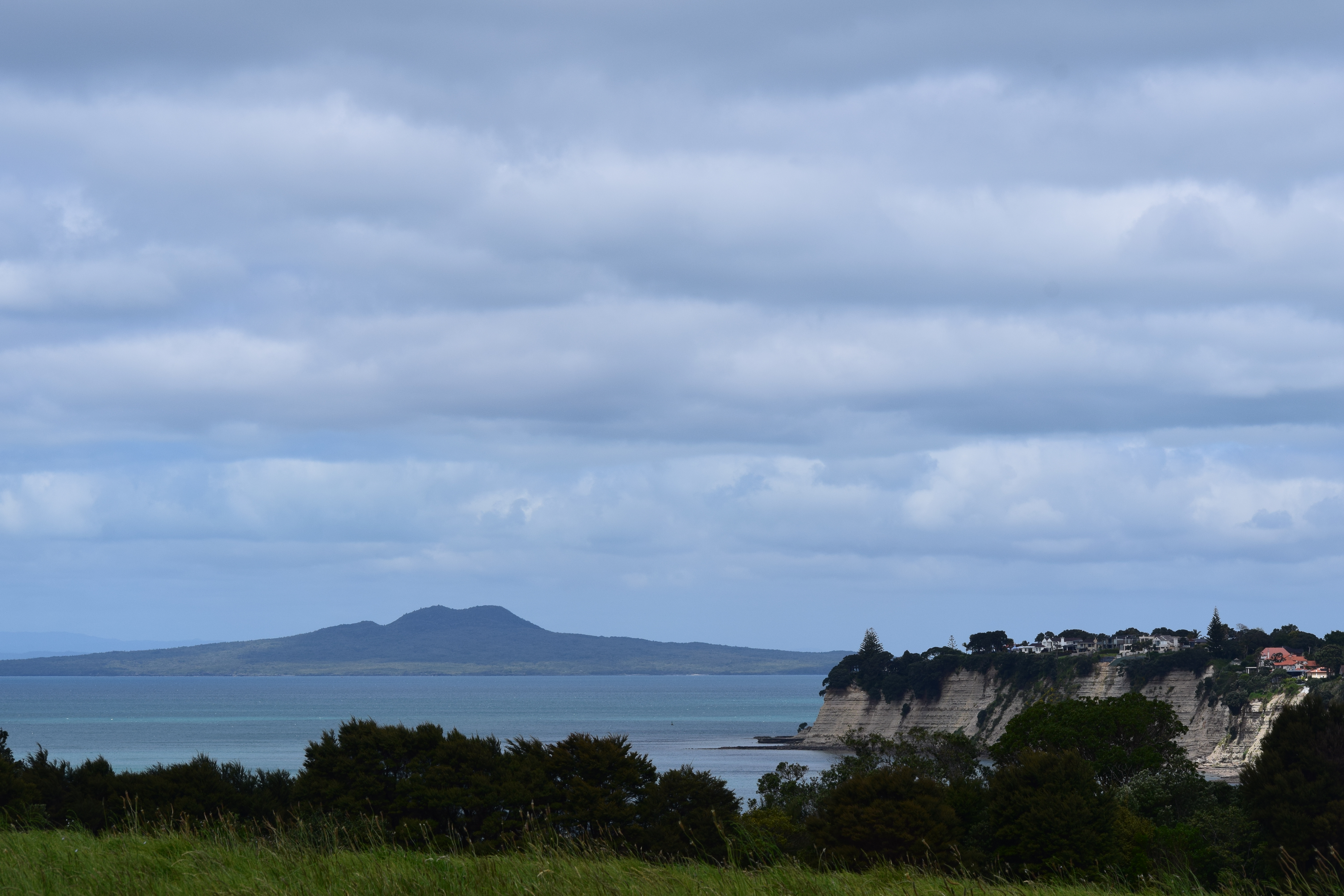
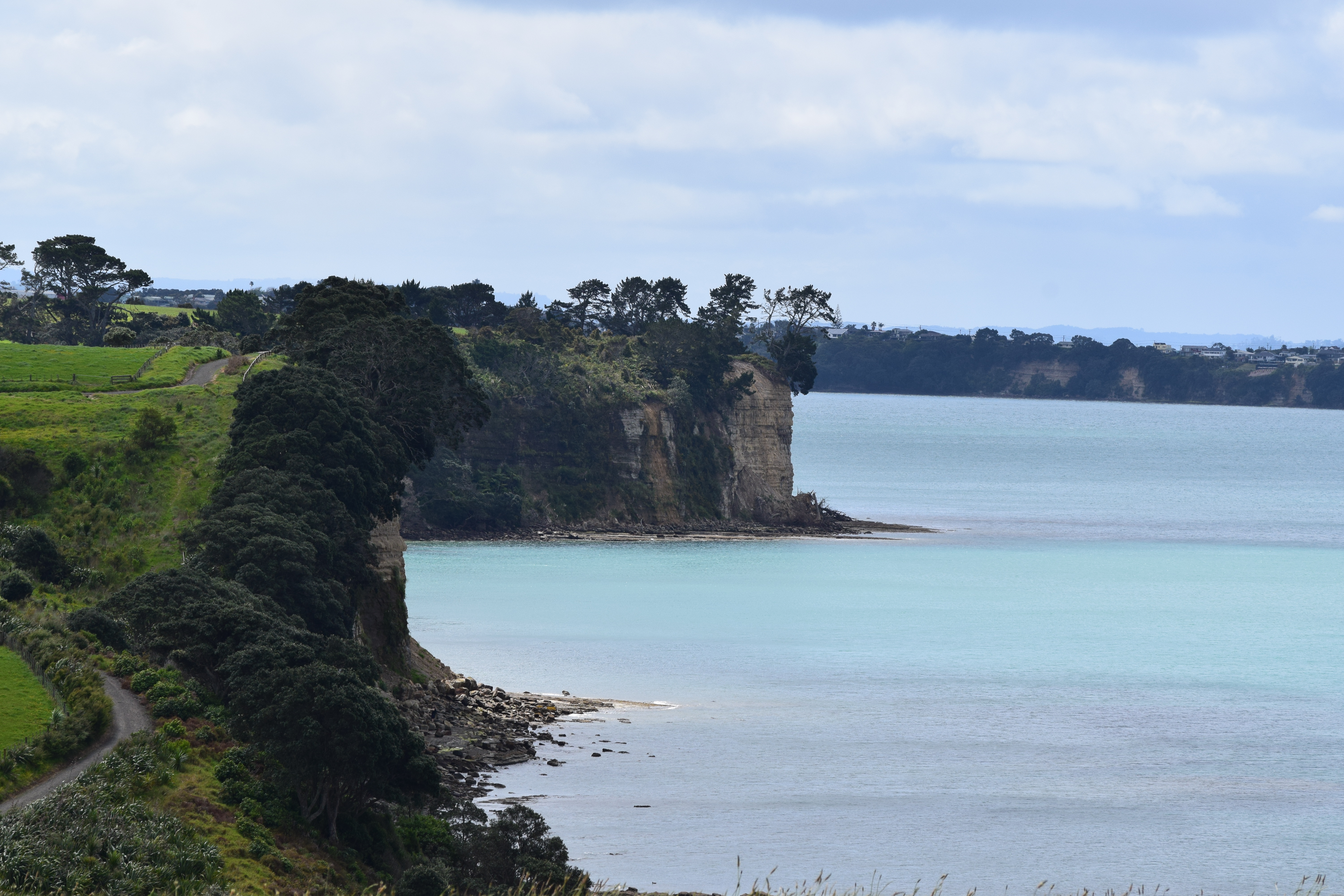
Long Bay does provide quite nice views of the Hauraki Gulf, dominated of course by the iconic Rangitoto.
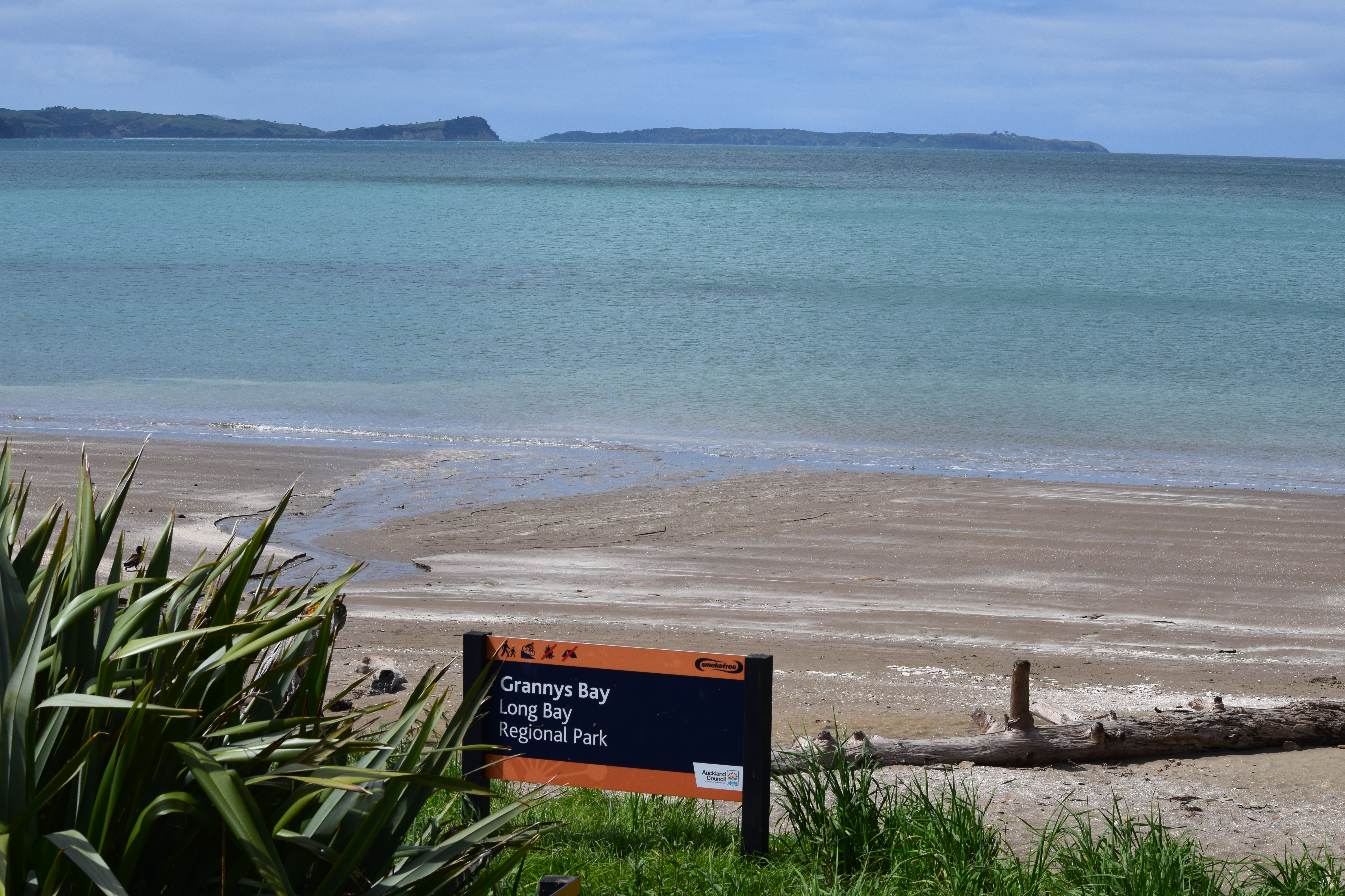
There are multiple opportunities to head down to the many beaches along the bay. This one is apparently Grannys Bay.

I took a brief break from stalking shorebirds to snap another shot of Rangitoto.

Also, a boat.
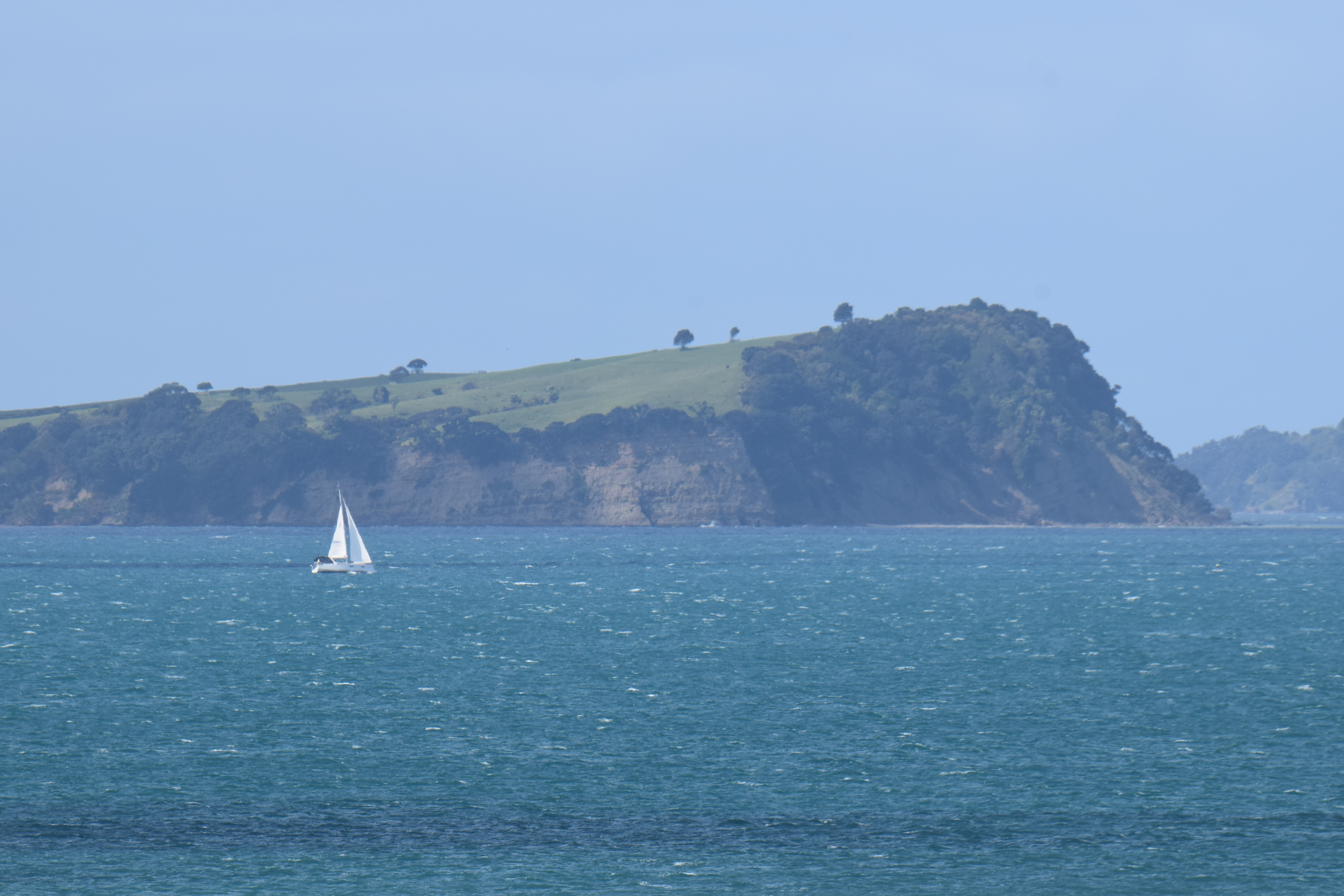
As well as another boat of somewhat smaller proportions.
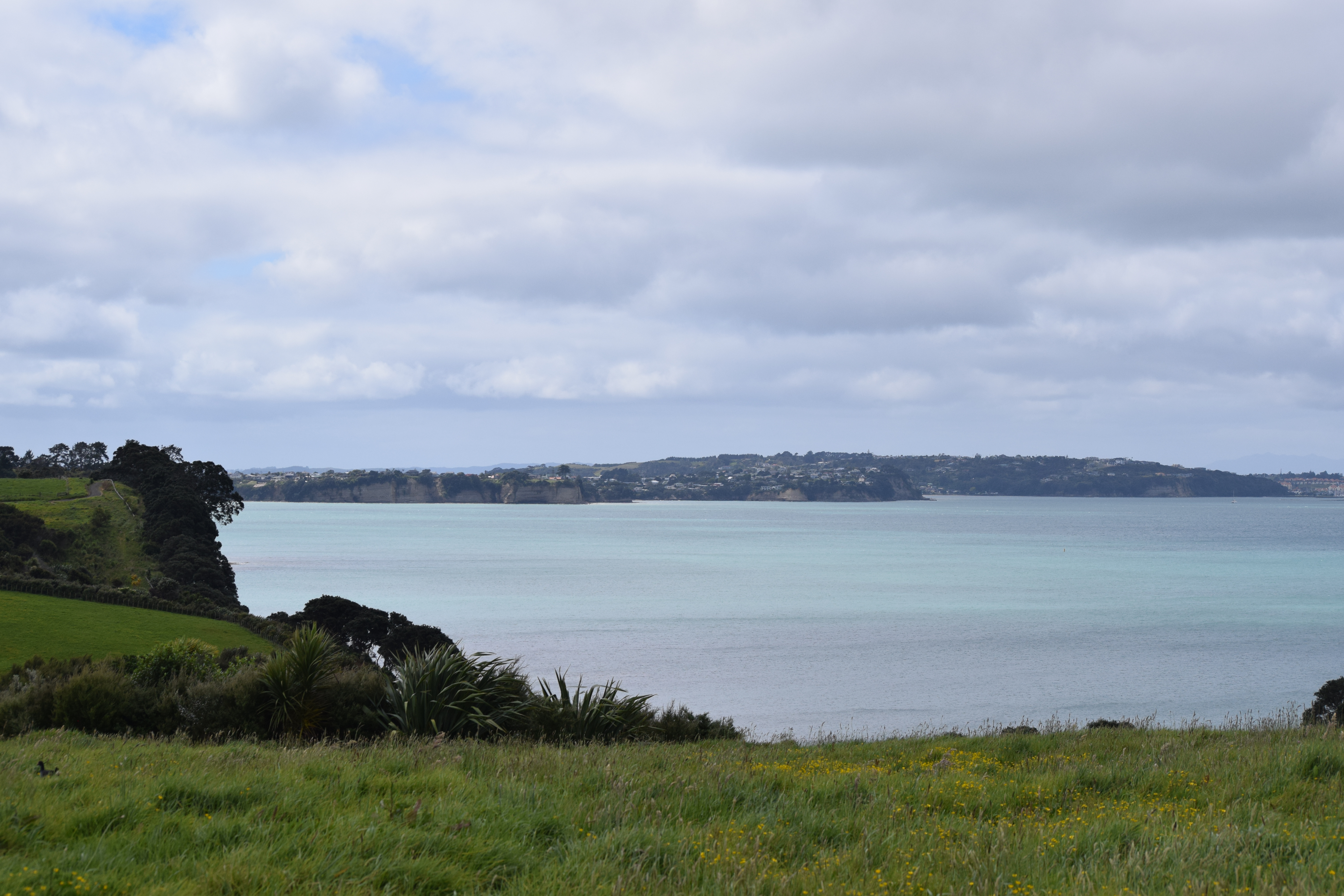
The bay is certainly very pretty, and this would probably have been a very worthwhile trip even sans birds.
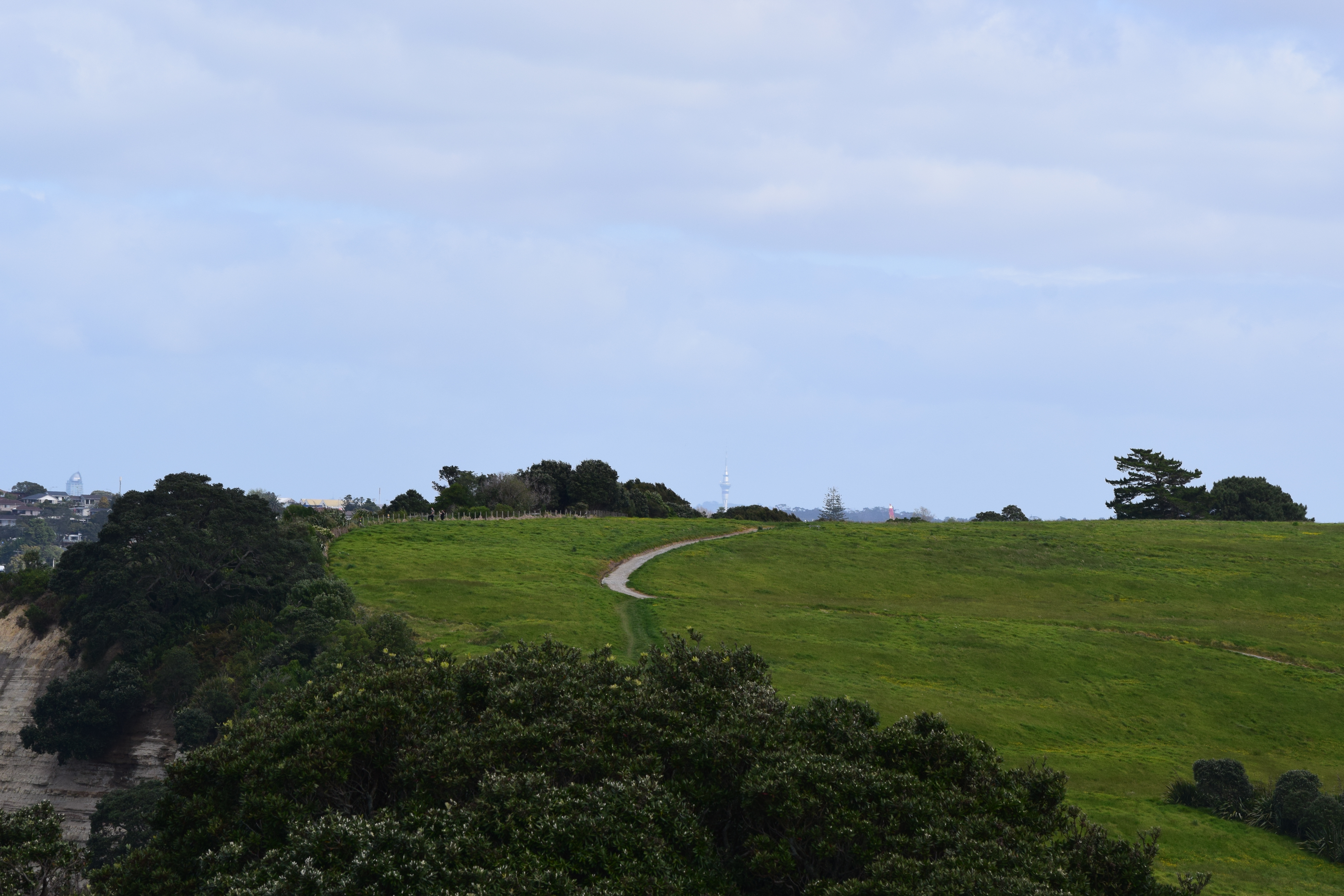
I was also amused to see the Sky Tower peeking up over this hill upon my return journey!
The Birds
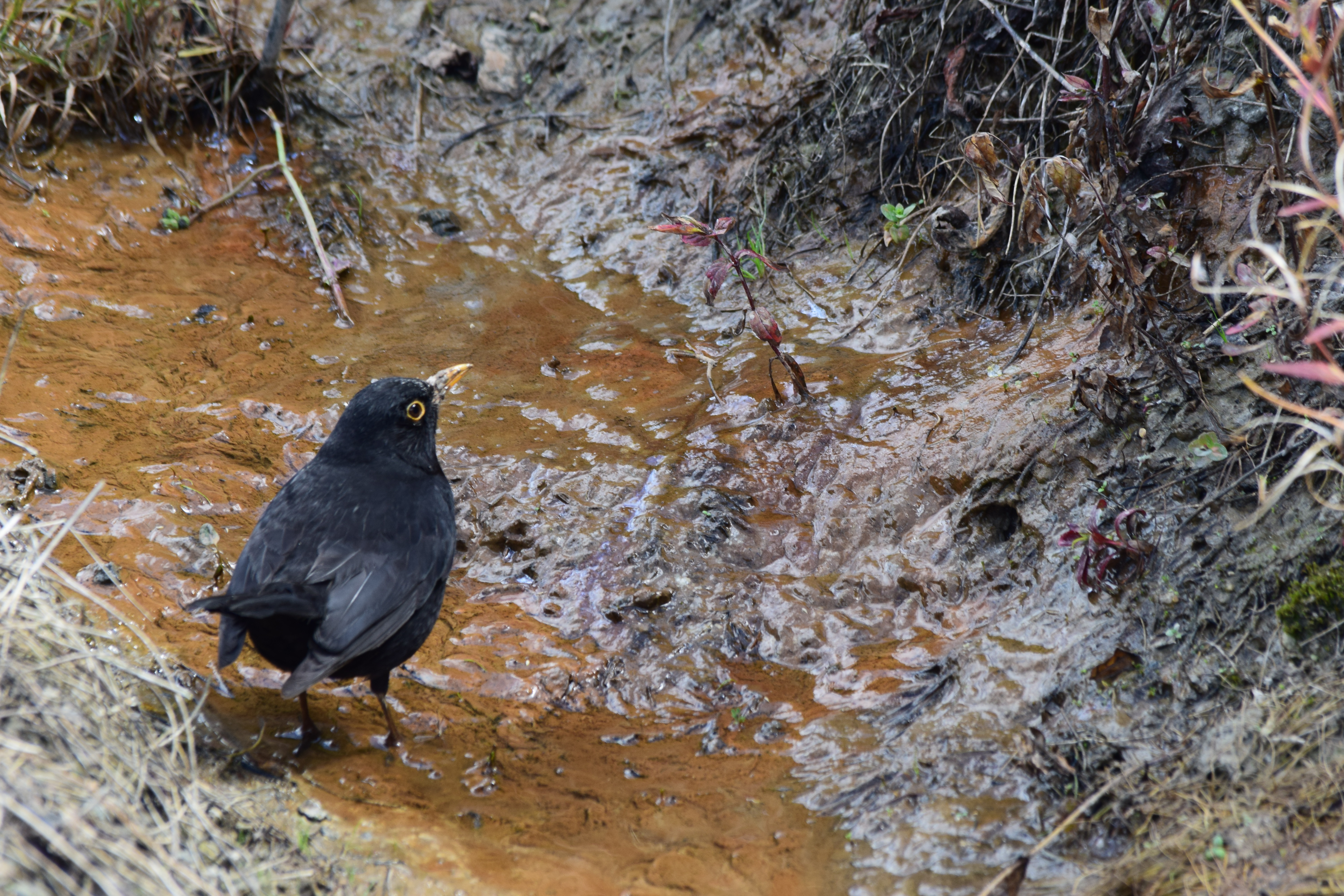
I first wet my beak, as it were, on this common Eurasian blackbird.

I also captured many duck photos on this trip. The ducks in Long Bay Regional Park are quite sociable.

I also offer for your consideration a rather poor photo of a European goldfinch, taken with the medium lens. I really only include it because I don’t yet have a photo of one of these birds on this site.

This photo of a kingfisher is not quite as good as the ones I took at Kendall Bay, but I cropped it so it looks better :)

I quite like this shot of an Eastern rosella. Getting this shot also required being far closer to the cliff edge than I was comfortable with, but I feel that it turned out well. This was taken at 550mm on the big lens!
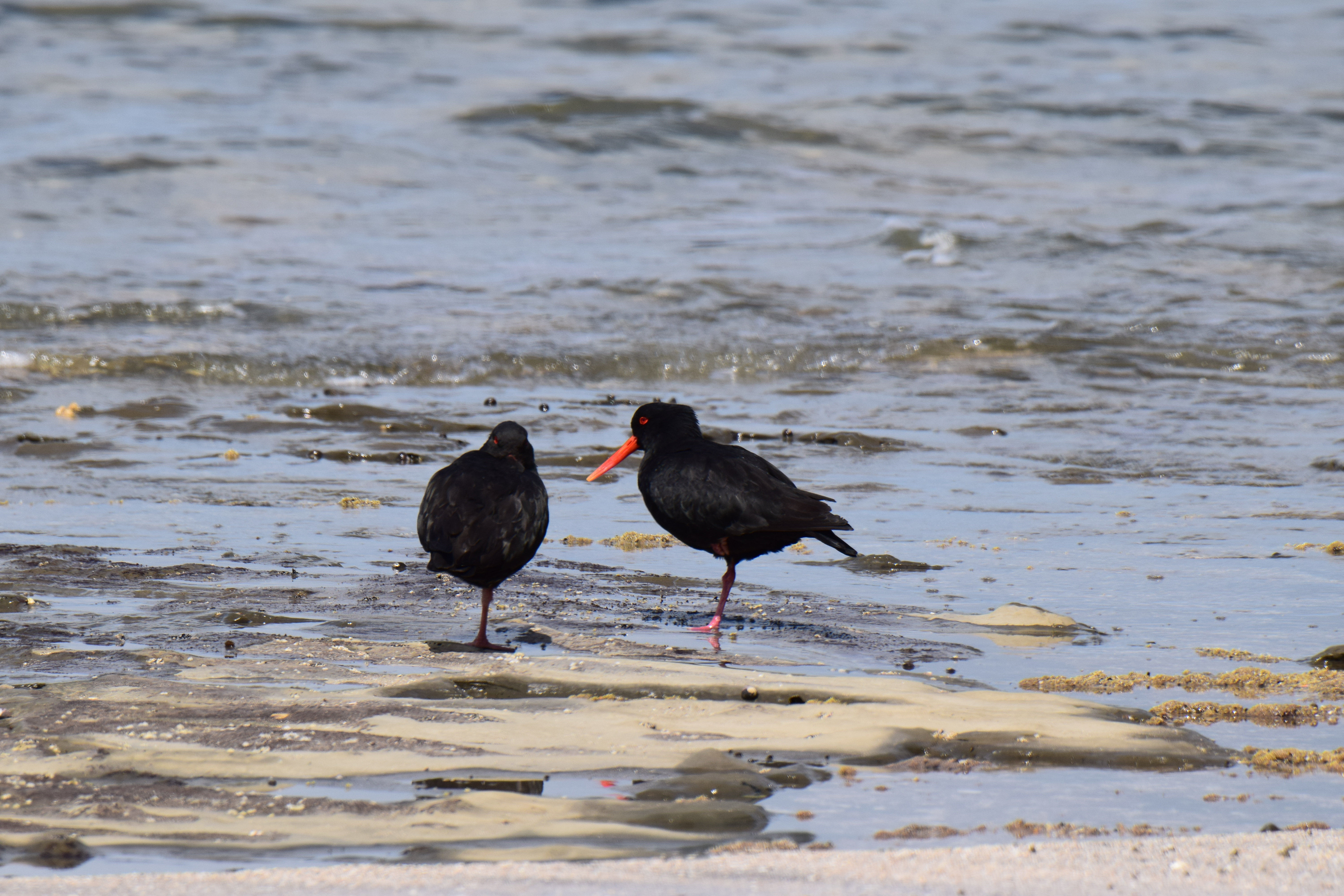
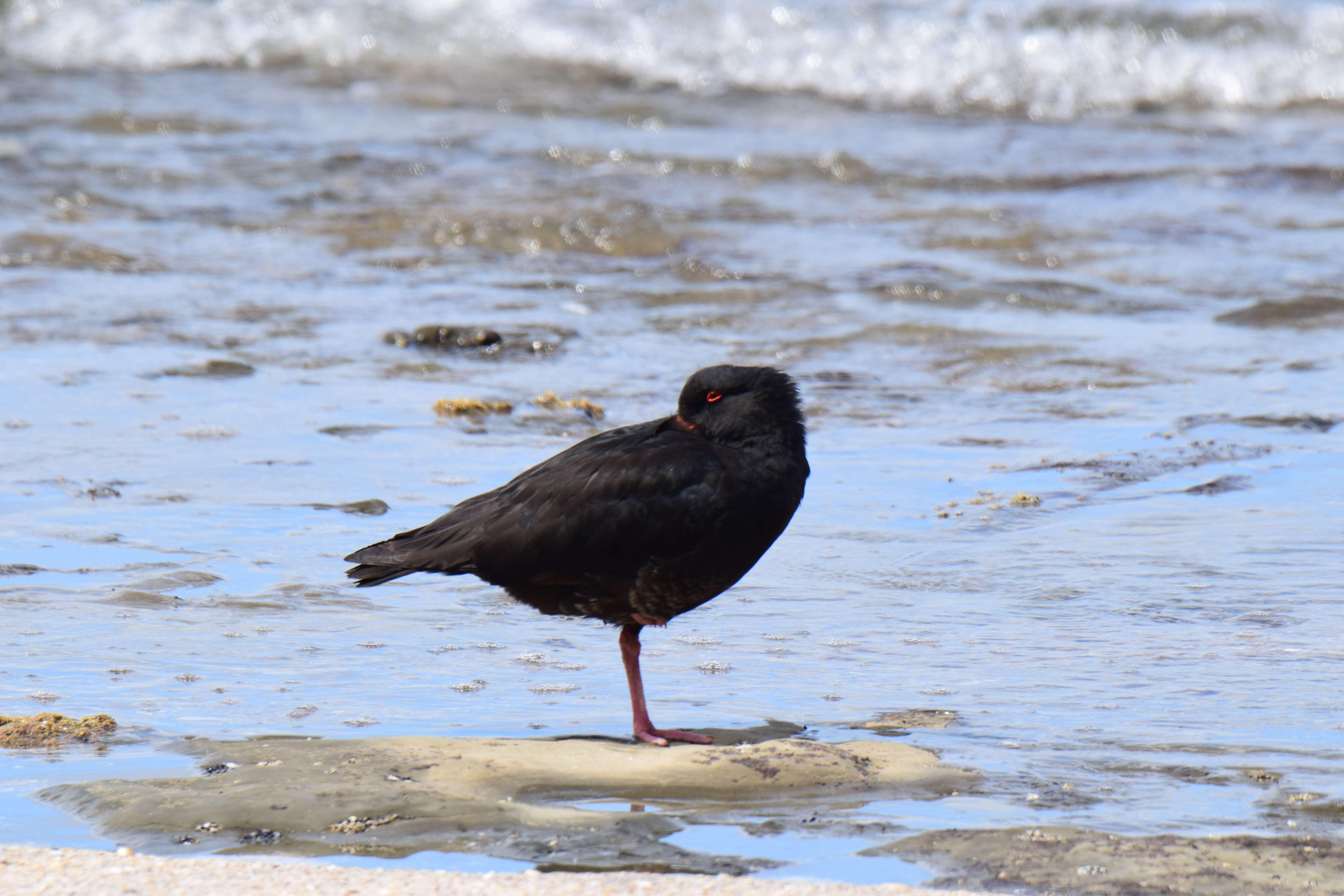
And finally, another new one for this blog: some variable oystercatchers. These birds are really cool looking, and I found two pairs and a singleton wandering around the bay.
I hope you enjoyed this quick and birdful trip up to Long Bay! I’ve got a few more of these short trips to post, and then something a bit longer :)
